
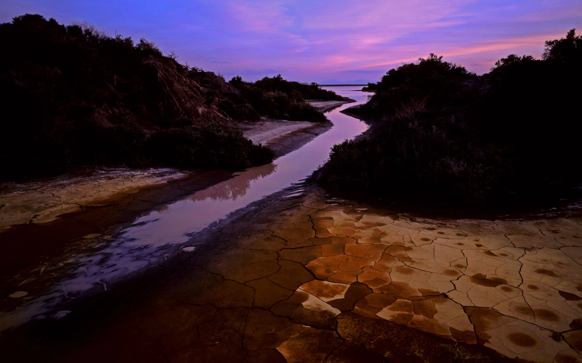
I am still standing on the promontory high above Leslie Gulch with my younger brother, Hans, almost 12 hours by car from Portland. The stone tools are back on the rock where we found them. We know what they were for: scraping the hide off a fresh kill. We don’t know what they hunted.
Hans suggests we look around for dung and answer that question ourselves. Almost immediately, we find whole big piles of the stuff — elk dung, coyote dung, rabbit pellets. He pokes around at the sun-whitened clumps, showing me the animal fur in the coyote dung, the big loose elk piles.
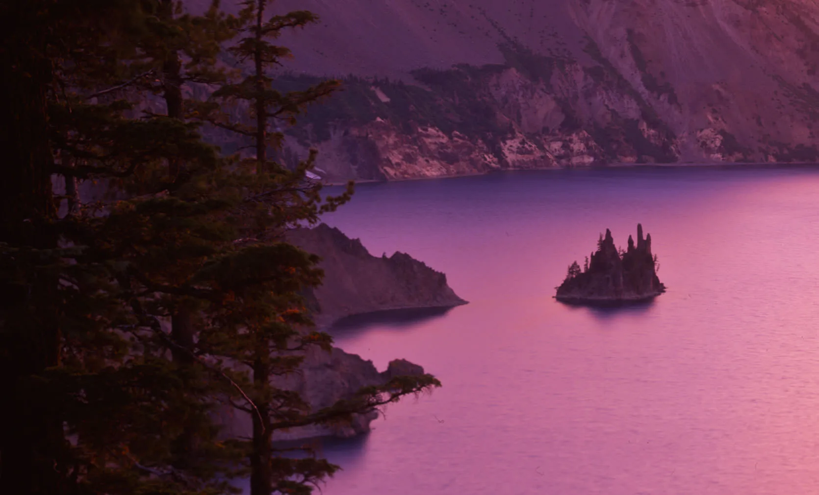
Phantom Ship at Crater Lake National Park, Oregon
Our position is a high point between two gulch systems. The creek at the bottom of the Leslie Gulch, and the path it creates toward the Owyhee River would make this passage a tempting one for large mammals.
We also know this part of Oregon was buffalo country, and that Native Americans had lived in the northern Great Basin for well over 14,000 years; people at Dirty Shame Rockshelter, just up the Owyhee drainage, abandoned it during a hot, dry mid-Holocene spell and returned when a wetter period began about 5,000 years ago. The change meant vast marshes and generally wet conditions for this northern border of the Great Basin. The Northern Paiute and Shoshone, whose Numic languages many scholars think spread across the Great Basin only about 1,000 years ago, are the Owyhee's historic peoples. Leslie Gulch was particularly suited for their lifestyle, and several petroglyph sites are found in the mazelike arroyos leading to the creek below.
Also, around 7,700 years ago, a roughly 12,000 foot volcanic mountain in Oregon’s Cascade range blew its top, its cone sank into itself; and the ensuing destruction ravaged Oregon. Dozens of tribes were severely affected by the catastrophic event. The populating of the Owyhee may have been due in part to the disaster in Oregon’s greener side.
The Mount Mazama event, which created what we now call Crater Lake, occurred within about five-hundred years of the time of the Great Flood in the Middle East. I love biblical archaeology, so I always wonder about the geological claim that the flood in the Epic of Gilgamesh and the flood in the Bible may be the same event; the spilling of the Mediterranean into the Black Sea, a hypothesis that remains hotly debated. Likewise, I wonder if people analyze Native American myths, and compare them to actual geological events. They do: the Klamath story of Llao, spirit of the underworld, battling Skell, the sky spirit, until Mazama's summit collapsed and Crater Lake filled the hole, is widely read as a memory of the eruption. And at Fort Rock Cave, sagebrush-bark sandals dated 9,100 to 10,400 years old lay sealed beneath Mazama's ash.
The last piece of information we know is that as the Ice Age large mammals disappeared across the continent, through hunting, climate change or both, people began to adapt to root and grass processing. Great Basin Indians, unlike their coastal or Cascades cousins, lived in harsh conditions which meant foraging and hunting consumed much of their lives.
We gave up on dung-watching, and began our way down the steep, grassy hill. These steep hills were once the domain of cattle; in fact almost all of Southeastern Oregon is cattle-grazing BLM land. But in 1999, Oregon's cattlemen lost the right to continue to graze on over a million acres of these steep hills, because by the 1990's, cattle grazing had polluted the complex riverine systems of the Owyhee, disturbing fishing areas, creating massive erosion problems and threatening unique plant species.
The Owyhee flows north and covers the corners of three states, beginning in Nevada, then Idaho, and finally through Oregon, into the Snake River.
Now these hills are protected as critically sensitive areas. There have been repeated attempts in recent years to make the Owyhee a national monument. Part of that goal, many cite, is to include better protection against these native sites being vandalized.
Guitars and a Mortar
After twilight, we return to the truck, and then back to camp. We gather some wood, make a small fire and pull out our backpacking guitars.
I pick along to Hans' playing, but my mind keeps wandering, and I say: "So an Indian or two would sit there at that hunting camp, waiting for an elk, but it's a long process of waiting, so they sat around and crushed seeds and stuff in the mortar."
Hans explains that it would be interesting to learn what grasses and sedges might have actually been used in Indian flours. He says there are hundreds of such plants in Oregon. "If you would go out and try to duplicate an Indian flour," he said, "it could take a whole year just to find the right plants."
Of course, we don't even know if the mortar was used for flour at all. "How do we know what time period those stone tools are from?" I ask.
Oregon is a good place to ask such a question, because the state’s culture, which places a priority on locally-grown, raised and hunted food, also is aware of its Native American past. Still, Oregon's common interest in its prehistory is symbolic at best. Powell's, one of the country's largest bookstores, takes pride in its large Pacific Northwest and Native American sections. Despite this, the books that look at Oregon's Native Americans historically are few and far between.
Neither of us have the answer to the stone tool's age, because we have already exhausted our Native American knowledge. The stone tools could have been made anywhere from 5,000 years ago to 100 years ago, as far as we're concerned. But answering that question fills my mind.
I tell Hans that Jane and I had recently been to the Warm Springs Museum, a tribally funded building north of Bend that celebrates the Native American history of that region. "Something about the place really struck me," I explained. But we let the subject go, and play a few more notes.
A Ceramic Squirrel in Jordan Valley
The next day, we drive south along the Idaho border. We had decided to buy our older brother a birthday present at the farthest possible corner in Oregon. That farthest corner is a town called Jordan Valley, population 239. The town is alive today with a cattle auction, and a rodeo. Deeply tanned men in cowboy hats loiter around the gas stations — they have come from as far as Wyoming to compete in the rodeo.
Cattle fill dozens of trucks, which fill the air with moos and groans.
Jordan Valley maintains its Basque, frontiersman, and even Native American roots fervently. When you compare Jordan Valley to Ontario, it is as if these two wildly different towns are from different continents. Jordan Valley is filled with potted plants and fresh grass and lively street banter.
We walk into the antiques shop, to buy a birthday present for big brother.
We reject the cowhide lamp, the Mickey Mouse salt shakers and finally come to agreement on a ceramic squirrel, holding a raspberry. A dollar fifty, says the cashier. We ask her about the rodeo. She says that the Jordan Valley rodeo “doesn’t apply to modern rodeos.” She says, “It’s a wilder rodeo, without all the safety nets of other rodeos. That’s why fellas from all over come this way.”
She looks embarrassed selling us a ceramic squirrel. She says, “Make sure you come back for the next rodeo!”
We continue south, and then southwest, to the town of Rome, which is a convenience store with bathrooms. The bathrooms are so small, that I have to sit in the sink to piss. At a table, we look at our gazetteer maps, and Hans points to a small lake at the lip of the Alvord Desert. He says it’s stocked with trout each year. We’re going fishing.
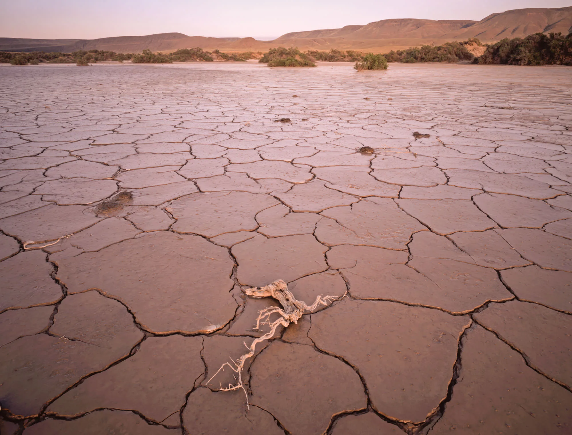
Dried mud flats in the Alvord Desert, a playa lying in the rain shadow of Steens Mountain.
Casting at Mann Lake
We drive for several hours west. Here, Steens Mountain rises from the desert floor a vertical mile; there are few mountain faces so dramatic.
We cast flies into Mann Lake for a while. Because of the late afternoon wind, Hans ties a heavy black fly on my line, so it cuts through the wind. I have been practicing flycasting for years. But most of it has been out on the street in my neighborhood in LA. This is my first time actually fishing for trout.
There isn’t much of a chance for a bite; but wading out into the frigid water with a backdrop of snow-capped peaks is refreshing. The fly-line in the air is rhythmic. Why do people like to fish so much? At one moment, the act of tying little pieces of feathers and hide together to imitate an insect, all for the sake of catching a smallish fish in an inconvenient way, seems inefficient.
The same could be said for those bass fishermen in the Owyhee, with their boat loans and tackle boxes. But then, the same could be said for gardening, too? What it is about so many people, making such an effort to collect their own food? Do people have some internal mechanism that makes them say to themselves– ‘I can still collect my own food’?
Without a catch, Hans and I speed off into the scrub flats; BLM roads cut through it all, winding around grazing cattle. The Alvord Basin is a long, flat stretch of cracked mud, sagebrush and alkali lakes. Thermal vents of scorching water steam in the afternoon sun. In pursuit of one such hot spring, the Mickey Hot Springs, we see a collection of miniature islands of sage and scrub, holding ground against the alkali water that covers much of this desert.
We walk out on the cracked mud, following the chain of islands that wrap around oddly geometric mud shapes. Hans notes a coyote hole on one of the islands, and says, ‘see, there is life even out here.’ But still, most life dies here. A cow lays dead in the mud, and no flies come to visit her.
A Hidden Camp Below the Steens
Some hippies we met at the Slocum Creek campground mentioned an old BLM campsite that was hidden between Steens Mountain and the Alvord desert, and so tucked away it was almost always nearly deserted. We find the advice to be worthwhile; the site is next to a river, and with shade.
We unload the truck and make a fire of twigs and sticks. A simple meal — bagels — and two bottles of red wine. As our eyes adjust, we see the expansive Alvord Desert, much of it covered with a thin cover of water. The Alvord Desert is a playa, the dry bed of Ice Age Lake Alvord, lying in the rain shadow of Steens Mountain, which looms above us at nearly ten thousand feet. The playa below, which is flat enough to land an airplane, is nearly lifeless, but it shimmers a pale blue in the moonlight.
It is my custom to keep a small library in my truck; mostly guidebooks and maps, but history books too. I am lucky enough to have two books on Oregon’s Native Americans. Hans and I exchange passages from each book, trying to figure out more about the Indians whose hunting site we uncovered a day before.
Later, Hans would come back to the idea of trying to duplicate the Indian flour that might have been created in that mortar. He also mentions that it is good that we photographed the lichen on one of the stone tools, because, with the help of a lichen expert, we might be able to date the age of the stone tool. Had our tool been obsidian, it might have offered better clues: labs in Oregon can match obsidian’s trace-element chemistry to its volcanic source with X-ray fluorescence, and obsidian hydration analysis can estimate how long ago a flake was struck. But ours is a beige stone. Somewhere in Oregon, I figure, there is a stone like ours, and someone who knows where it came from.
But in the pale light of the Alvord Desert, with a few sticks and twigs turning to embers, I announce my better idea. I remind Hans that he’ll be leaving Oregon for a year — it is up to me to unravel the Owyhee puzzle. I am going to spend a year recreating old Oregon Indian customs, I explain, I am going to learn about the world that that stone tool came from, by adopting that world.
He reminds me that I can’t do a hack job. If I am going to recreate that Indian flour, if I am going to eat, forage, fish and hunt like Oregon’s Native Americans, I’ll have to seek out experts: clam diggers, ethnobotanists, bow-hunters, mushroom collectors, tribal councils, salmon smokers.
We talk about Ontario, with its Walmarts. And Jordan Valley, with its rich culture. Out here, what happens when small towns shed their culture, and replace it with big Walmarts and 7 hours of television? Do old ideas matter? Should Oregonians be conscious of the old Native American ways, the ways that ruled these mountains for more than 14,000 years?
The Slow Way
A few weeks later, Hans and I are back in Portland, and he is packing for his year away. He was right at the campfire. I can’t simply adopt a way of life that took thousands of years to build. But I can learn it, one expert at a time, the slow way.
The stone tool is still on its ledge above Leslie Gulch, where we left it. The question it raised has come home with me: who shaped it, what did they hunt, and what did they grind in that mortar while they waited?
So I start with Hans’s list: clam diggers, ethnobotanists, bow-hunters, mushroom collectors, tribal councils, salmon smokers. And I start where the puzzle first found me, with our friends at Tryon Farm, who since last year have raised 1.6 million dollars to turn seven acres of proposed condominiums into an organic and sustainable community center. If anyone in Portland knows a clam digger or an ethnobotanist, it’s someone at their table.