Fowl Cays National Park Map
I created this map of Fowl Cays National Park, Abaco Islands for my notes on the Bakers Bay conflict and more specifically, the Bakers Bay Barge and Tugboat incident in the Fowl Cays.
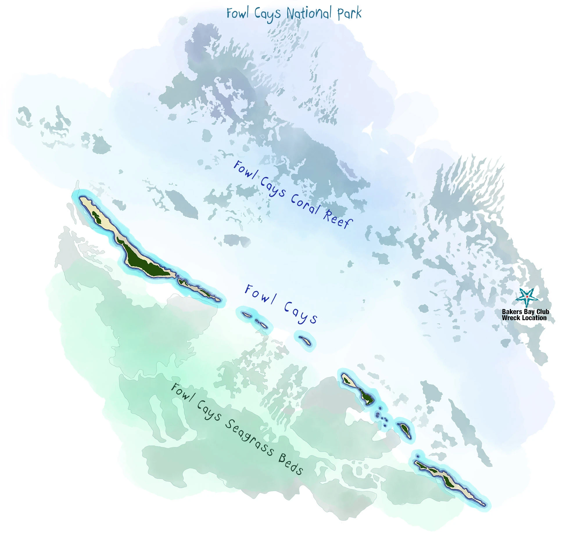
Fowl Cays National Park is a 2,335-acre protected Bahamian National Park located in the Abaco Islands of the Bahamas and established in 2009. The park includes coral reefs, seagrass beds, rocky shores, and seagrass beds. It serves as a habitat for bountiful marine species such as surgeonfish, grunts, parrotfish, and endangered corals like staghorn and elkhorn. A staghorn coral nursery was established in the park in 2017 to aid in coral restoration efforts. In March 2024, a tugboat and barge transporting construction materials for the Bakers Bay development ran aground on the reef within Fowl Cays National Park. The grounding occurred during rough seas in the Man-O-War Cay channel. Since then, the vessels have remained stranded, causing ongoing damage to the reef ecosystem. I wrote more extensively about the Bakers Bay wrecks here.