
Ecuador Map
A watercolor map of Ecuador, from the Pacific coast over the Andes to the Amazon.
Updated September 29, 2026
Stories from Ecuador: Quito · Papallacta Pass · Guacamayos Ridge · Coca and the Amazon
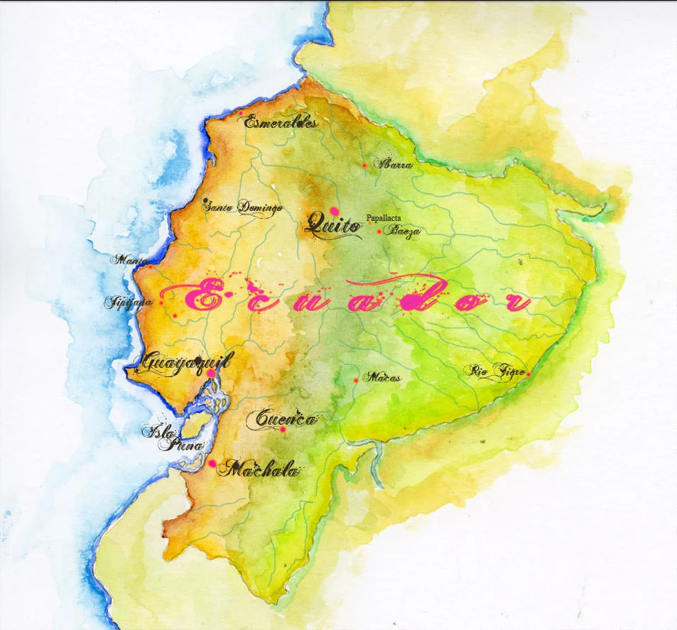
Ecuador takes its name from the equator, which runs just north of Quito, and for a country roughly the size of Colorado it holds an astonishing range of landscapes. There are really four Ecuadors: the dry and humid lowlands of the Pacific coast; the Andes, which split the country down the middle; the Oriente, the Amazon rainforest to the east; and the Galápagos Islands, some six hundred miles out in the Pacific. Squeezed together along the equator, these regions make Ecuador one of the most biodiverse countries on Earth, with more than 1,600 species of birds, more than in all of North America.
West of the Andes, the land falls away to the Pacific lowlands. In the north, around Esmeraldas, the coast is wet and green, the southern end of the Chocó rainforest that runs up into Colombia. Farther south it dries into the scrub and dry forest around Manta and Jipijapa, shaped by the cold Humboldt Current offshore. Guayaquil, the country’s largest city and its great port, sits on the Guayas River where it opens into the Gulf of Guayaquil behind Isla Puná, and the plantations around Machala help make Ecuador the world’s leading exporter of bananas. In the southern Andes, above the coast, lies Cuenca, the old colonial city of the south.
The Andes in Ecuador run as two parallel ranges with a high valley between them, lined with snow-capped volcanoes that the explorer Alexander von Humboldt called the Avenue of the Volcanoes. Chimborazo is the highest, and because the Earth bulges at the equator, its summit is the point on the planet farthest from the Earth’s center. Quito, at more than 9,000 feet, is one of the highest capital cities in the world. East of the city, the road climbs through the cold, windswept páramo of Papallacta Pass, above 13,000 feet, before plunging down the eastern slope of the Andes into cloud forest, where I explored the Guacamayos Ridge and filled a Moleskine journal with the birds and insects of San Isidro.
Below the Andes, the rivers gather into the Napo and flow east toward the Amazon. This is the Oriente, one of the richest rainforests in the world, and Yasuní National Park here may hold more species per acre than almost anywhere else on the planet. My own trip there began in the river town of Coca, and continued by boat to the river islands of the Napo and the blackwater lakes of the flooded forest, all of which I also recorded in my Amazon sketch journal.