
Map of Celestún
This Copic Sketch marker map of the town of Celestún and the Celestún Biosphere Reserve. Celestún is situated on a long peninsula, isolated from the Yucatan mainland by the Ria Celestún.
Updated September 29, 2026
Stories from Celestún: Celestún Biosphere Reserve
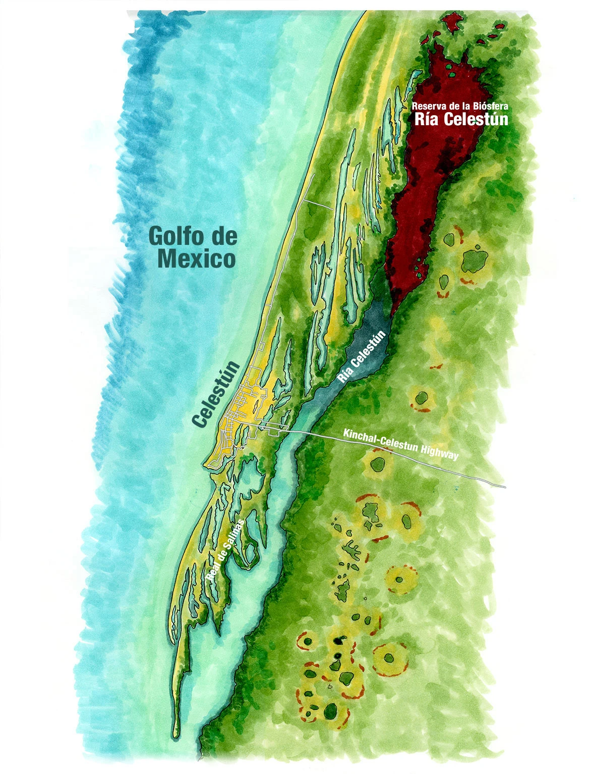
Celestún sits at the far western edge of Mexico’s Yucatán Peninsula, where the flat limestone country meets the Gulf of Mexico. The town is built on a long, narrow spit of sand, with the open Gulf on one side and the Ría Celestún on the other, a shallow estuary that runs parallel to the coast for miles behind it. The only road in is the highway from Kinchil, which crosses the ría on a bridge and ends at the beach, so the town has the feel of an island. North and south of it, the map shows a coast combed into long, parallel ridges of sand and mangrove.
The estuary and the country around it are protected as the Ría Celestún Biosphere Reserve, which reaches south across the state line into Campeche. The northern reaches of the ría, painted here in deep red, are hypersaline, and their waters can glow pink and red with the brine shrimp and algae that feed the reserve’s American flamingos, which gather here by the thousands. Along the channel stand tall red mangroves, fed by freshwater springs, the cenotes, that rise through the limestone. To the east, the marsh is scattered with round hammock islands of forest. South of town, at Real de Salinas, stand the ruins of an abandoned salt-making settlement. Salt has been gathered on this coast since before the Spanish arrived, and in the Maya world it was one of the most valuable goods of all.
My Travels in Celestún
I came to Celestún from Mérida, where my son was staying with a Yucatecan family, and spent my days in the reserve with local guides, out on the ría at dawn among the flamingos and on foot through the coastal scrub to the ruins at Real de Salinas. I wrote about it in Ghosts of Celestún Biosphere Reserve.