
St. Lucia Map
A hand-painted map of St. Lucia, from Pigeon Island to Vieux Fort.
Updated September 29, 2026
Stories from St. Lucia: St. Lucia and the botanical history of the Antilles · St. Lucia sketches
I created this map of Saint Lucia with Copic markers. This beautiful Caribbean island is very small at only 240 square miles. But as a volcanic island, the interior is very mountainous, lengthening distances through the interior.
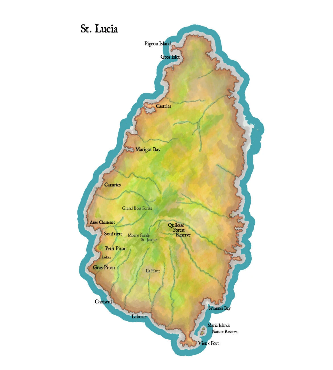
St. Lucia is one of the Windward Islands of the Lesser Antilles, a single volcanic island about twenty-seven miles long and fourteen wide, with Martinique to the north and St. Vincent to the south. On this map it runs from Pigeon Island and Gros Islet at its northern tip to Vieux Fort in the south. Nearly every river starts in the same place, the forested spine at the center of the island, and falls away from it to the sea. That spine holds the interior reserves, the Grand Bois Forest, Morne Fond St. Jacques and the Quilesse Forest Reserve, on the flanks of Mount Gimie, the island’s highest peak at a little over 3,000 feet.
The west coast is the leeward coast, a string of fishing villages and deep bays: Castries, the capital, then Marigot Bay, Canaries, Anse Chastenet and Soufrière, the old French town beneath the Pitons. Gros Piton and Petit Piton are volcanic spires that rise nearly half a mile straight out of the sea south of Soufrière, and with the sulphur springs of the collapsed volcano behind town they are a UNESCO World Heritage Site. Past Choiseul and Laborie the land flattens toward Vieux Fort and the Atlantic.
Britain and France fought over the island for a century and a half, and it changed hands more than a dozen times. Pigeon Island, now joined to the mainland by a causeway, was the British fort where Admiral Rodney kept watch on the French fleet at Martinique before the Battle of the Saintes in 1782. The rainforest is home to the St. Lucia parrot, or Jacquot, the national bird, brought back from the edge of extinction. Off Vieux Fort, the two small Maria Islands are a nature reserve and the last refuge of the St. Lucia whiptail, a lizard long gone from the main island, and of the St. Lucia racer, one of the rarest snakes in the world.
My Travels in St. Lucia
Jane and I drove a jeep up into the rainforest reserves of the interior with a local guide, Philippe, above the clouds on Mount Gimie. I wrote about that trip, and about the plants that shaped the history of the Caribbean, in St. Lucia and the Botanical History of the Antilles. The sketches I made along the way are in my St. Lucia Moleskine Journal Notes. For the rest of the Caribbean, see my West Indies map.