
Loreto Islands Map
A hand-painted map of the five islands of Loreto Bay, in the Sea of Cortez off Baja California Sur.
November 15, 2026
Stories from the islands of Loreto: Islands of the Painted Sea
Five desert islands lie off the town of Loreto, on the Sea of Cortez side of Baja California Sur: Coronados, Carmen, Danzante, Montserrat and Santa Catalina. Together with the water between them they make up Bahía de Loreto National Park, established in 1996, and they are part of the Gulf of California World Heritage Site. I painted this map in watercolor.
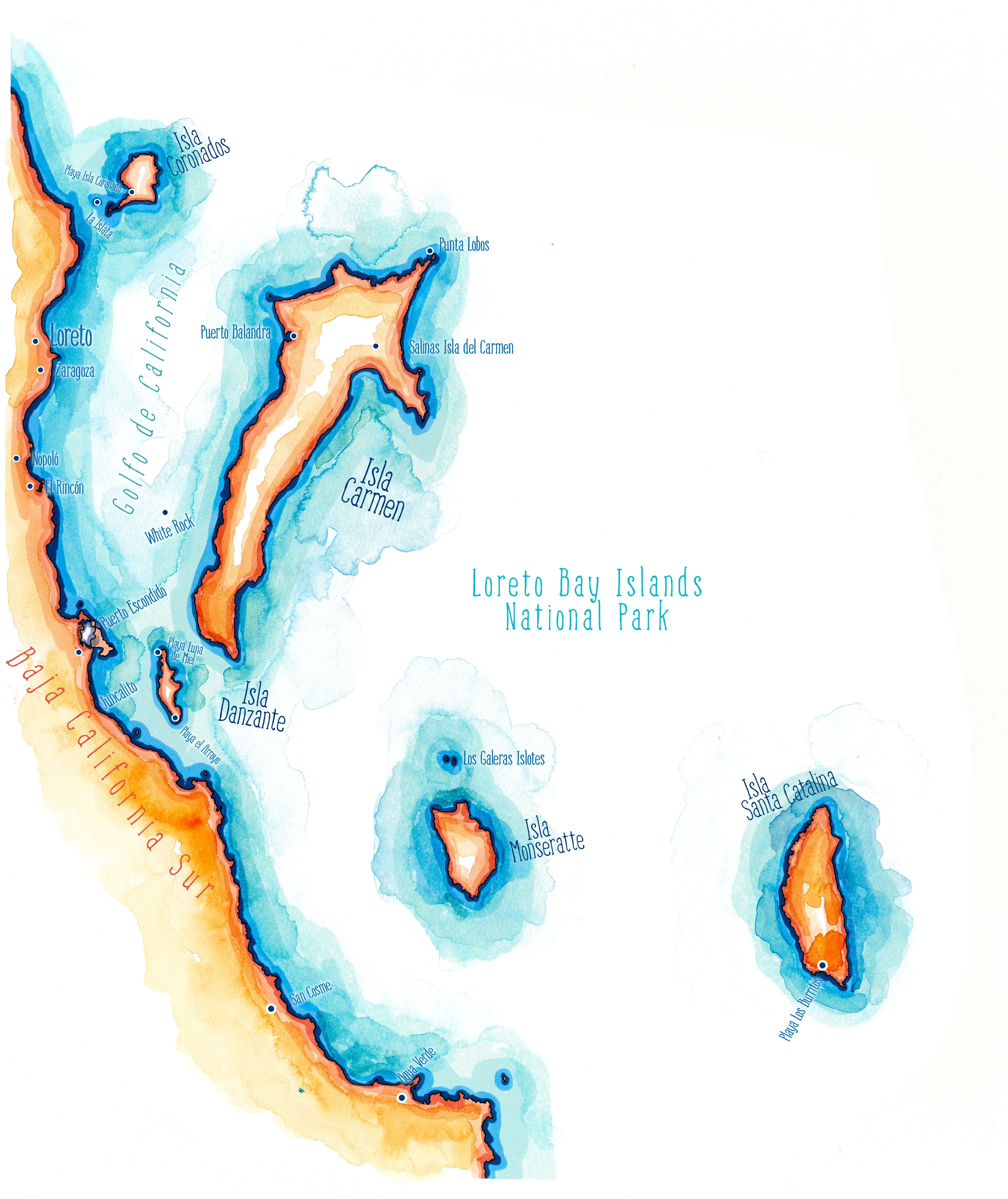
On the map the islands run from north to south along the coast. Coronados, an old volcano with a white sand spit, sits closest to Loreto. Carmen is the largest by far, a long island with Puerto Balandra on its western shore, Punta Lobos at its northern tip and the salt flats of Salinas behind its eastern bay. Danzante lies just off Puerto Escondido, small and steep. Montserrat and Santa Catalina stand farther out, beyond the reach of most day boats. Behind the mainland shore, from Loreto and Nopoló south to Agua Verde, rises the long red wall of the Sierra de la Giganta.
People crossed to these islands long before the park existed. Shell middens on their shores are among the only evidence of the islanders, and the Spaniards who landed on Carmen and Danzante in 1633 met people on both. The Jesuits took salt from Carmen from 1698, and salt was cut there until the works closed in 1984. Pearl divers worked the same waters until the oyster beds gave out.
Blue-footed Boobies fish around the islands, mobula rays leap in the channels, and the Least Storm-Petrel, the smallest of its order, nests on islands in this sea. Santa Catalina, the most remote of the five, is home to a rattlesnake that has no rattle and is found nowhere else.
My Travels in Loreto Bay
I spent my days in Loreto on the water with Duvi, a boat captain who took me to the three islands a small boat can reach in a day: Coronados, Carmen and Danzante. On Coronados I stood on a mound of shells without understanding what it was, and that mistake became Islands of the Painted Sea. For the rest of the peninsula, see my Baja Peninsula map.