
Hispaniola Map
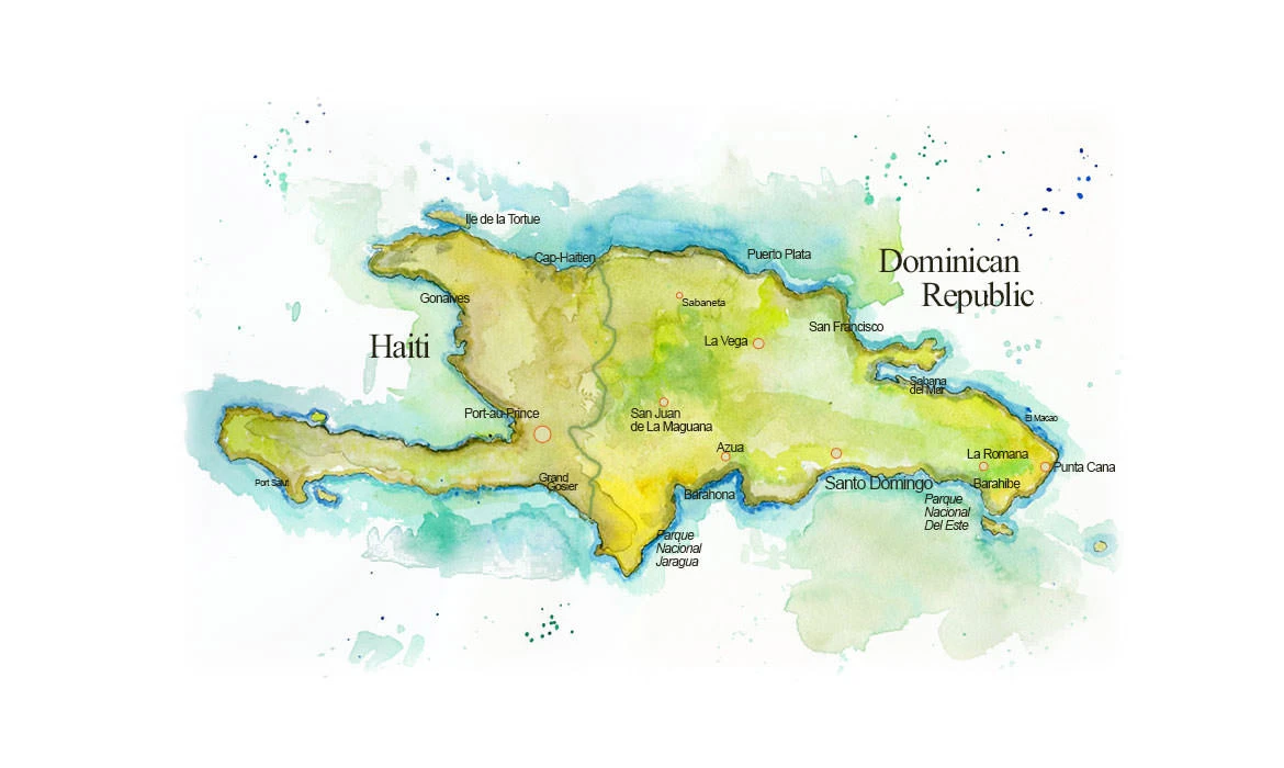
I used watercolors to paint this map of Haiti and the Dominican Republic.
Updated September 29, 2026
Stories from Hispaniola: Dominican Republic sketch journal · Dominican Republic Moleskine
Hispaniola is the second-largest island in the Caribbean after Cuba, and the only large island in the West Indies split between two nations. Haiti holds the western third, the Dominican Republic the eastern two-thirds, and the border between them runs north to south through mountains and river valleys, from Monte Cristi Bay on the Atlantic side to Pedernales on the Caribbean. The Taíno called the island Ayiti, the land of mountains, and Haiti took the name back when it won its independence in 1804, the first nation founded by people who had freed themselves from slavery.
The mountains are the key to the island. Hispaniola is really two ancient islands pressed together, a northern block and a southern one, and the seam between them is a long, low trough that runs from Port-au-Prince east to Lake Enriquillo. On one side of that seam stands Pico Duarte, in the Cordillera Central, the highest mountain in the Caribbean at just over 10,000 feet. On the other lies Lake Enriquillo, a salt lake that sits well below sea level. Haiti’s long southern arm, the Tiburon Peninsula, runs out toward Jamaica, and its northern arm reaches toward Cuba, with the Gulf of Gonâve between them and Île de la Tortue, the old Tortuga of the buccaneers, off the north coast.
That split geology gave the island a bestiary of its own: the solenodon, a venomous, shrew-like mammal whose ancestors survived the asteroid that ended the age of dinosaurs; the palmchat, the only member of its bird family; the narrow-billed tody; and the Jaragua dwarf gecko, one of the smallest reptiles on Earth, from the park at the southern tip of the Barahona Peninsula that I marked on this map. Columbus built his first settlement in the Americas on the north coast near Cap-Haïtien, and Santo Domingo, founded a few years later on the south coast, is the oldest continuously inhabited European city in the Americas.
My Travels on Hispaniola
I came to Hispaniola for a wedding in Punta Cana, and a missed flight turned the trip into a drive across the whole Dominican Republic, from Puerto Plata on the north coast to the far eastern tip of the island. I wrote about that drive, and the half-built resorts along the way, in my Dominican Republic Sketch Journal. Before the trip I spent weeks drawing the island’s birds and reptiles, and those pages are in my Dominican Republic Moleskine Journal. For the rest of the Caribbean, see my West Indies map.