
HawaiianIslands Map
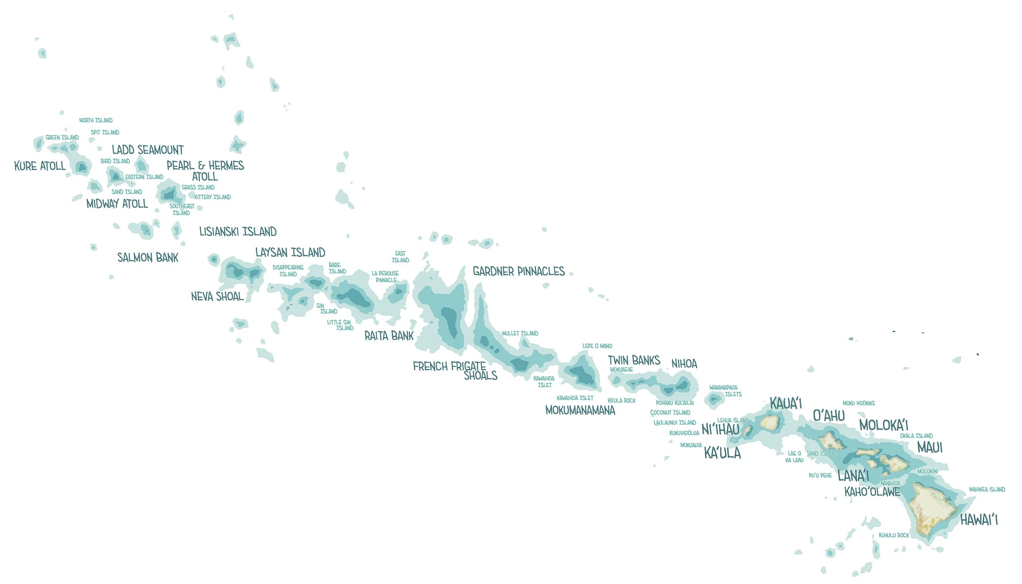
Two maps of Hawaiʻi: the full 1,500-mile archipelago and the eight main Hawaiian Islands.
Updated September 29, 2026
I created this map of the entire Hawaiian Islands archipelago using Adobe Fresco and physical watercolor and Copic pens. This island chain stretches all the way from Hawaiʻi Island to Kure Atoll and includes not just the main islands, but the tiny atolls, shoals, rocks, and remote fragments scattered across the Northwestern Hawaiian Islands. Maps that depict all the minor Hawaiian Islands simply do not exist online, and I wanted to create a map that changed that. Still, that land geography is so tiny compared to the main islands that my depiction of them is actually the depths around them.
The chain is a record of time. Each island was built in turn as the Pacific Plate slid northwest over a hot spot in the Earth’s mantle, so the islands grow older the farther they lie from Hawaiʻi Island, which Kīlauea is still building today. To the northwest, the old volcanoes erode and sink until only pinnacles and reefs remain: Nihoa and Mokumanamana, Lalo, Laysan, Midway and finally Kure. These northwestern islands are protected as Papahānaumokuākea Marine National Monument, one of the largest marine protected areas on Earth. They are the breeding grounds of the Laysan albatross, the Hawaiian monk seal and the green sea turtle, and home to birds found nowhere else, like the Nihoa finch. On Nihoa and Mokumanamana, Native Hawaiians built stone shrines long before any European ship arrived.
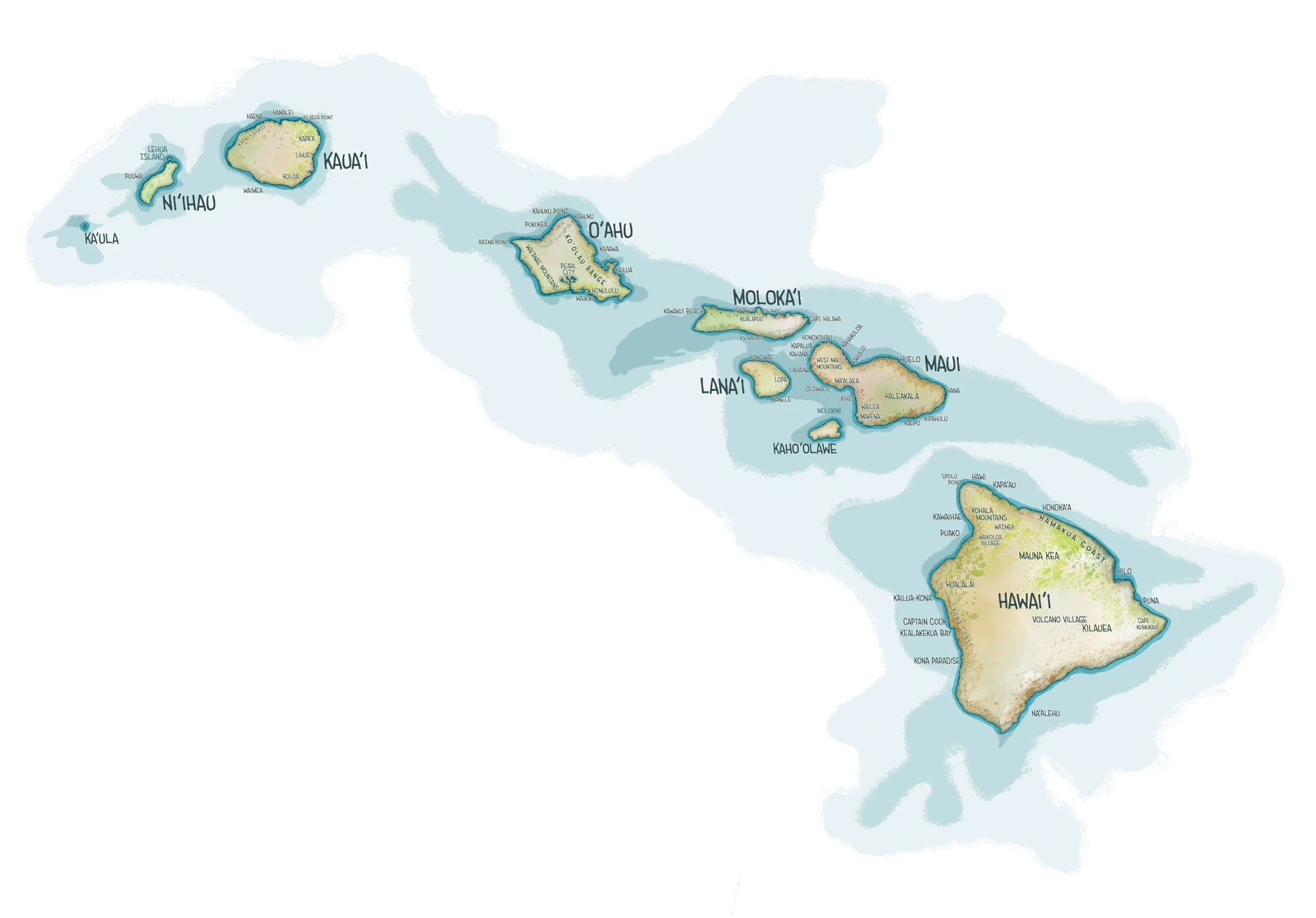
8 Major Hawaiian Islands Map
My second map, the more classic view of the Hawaiian Islands, focuses on the eight main Hawaiian Islands in greater detail. The map includes Hawaiʻi Island, Maui, Kahoʻolawe, Lānaʻi, Molokaʻi, Oʻahu, Kauaʻi, and Niʻihau, and was created with Adobe Fresco and physical watercolor and Copic pens.
The main islands lie more than two thousand miles from the nearest continent. Kauaʻi, the oldest, is carved into deep valleys and sea cliffs. Oʻahu is the remains of two volcanoes, the Waiʻanae and Koʻolau ranges painted here. Maui is two volcanoes joined by an isthmus, the West Maui Mountains and Haleakalā, and in the ice ages, when the seas were lower, Maui, Molokaʻi, Lānaʻi and Kahoʻolawe were joined as a single island. On Hawaiʻi Island, Mauna Kea, measured from its base on the sea floor, is the tallest mountain on Earth. Isolation gave the islands their own birds, from the nēnē to the honeycreepers of the high forests.
My Travels in Hawaiʻi
On Kauaʻi’s north shore, drives with my son past the taro ponds of Hanalei led to Roundup and Runoff in the Hanalei Valley, and my sketches from the island are in the Kauai Sketch Journal and Kauai Moleskine Journal. On the Kona coast of Hawaiʻi Island, I paddled the bay where Captain Cook was killed in Paddling Kealakekua Bay.