Guana Cay Map
I created this map of Great Guana Cay, Abaco Islands for my notes on the Bakers Bay conflict.

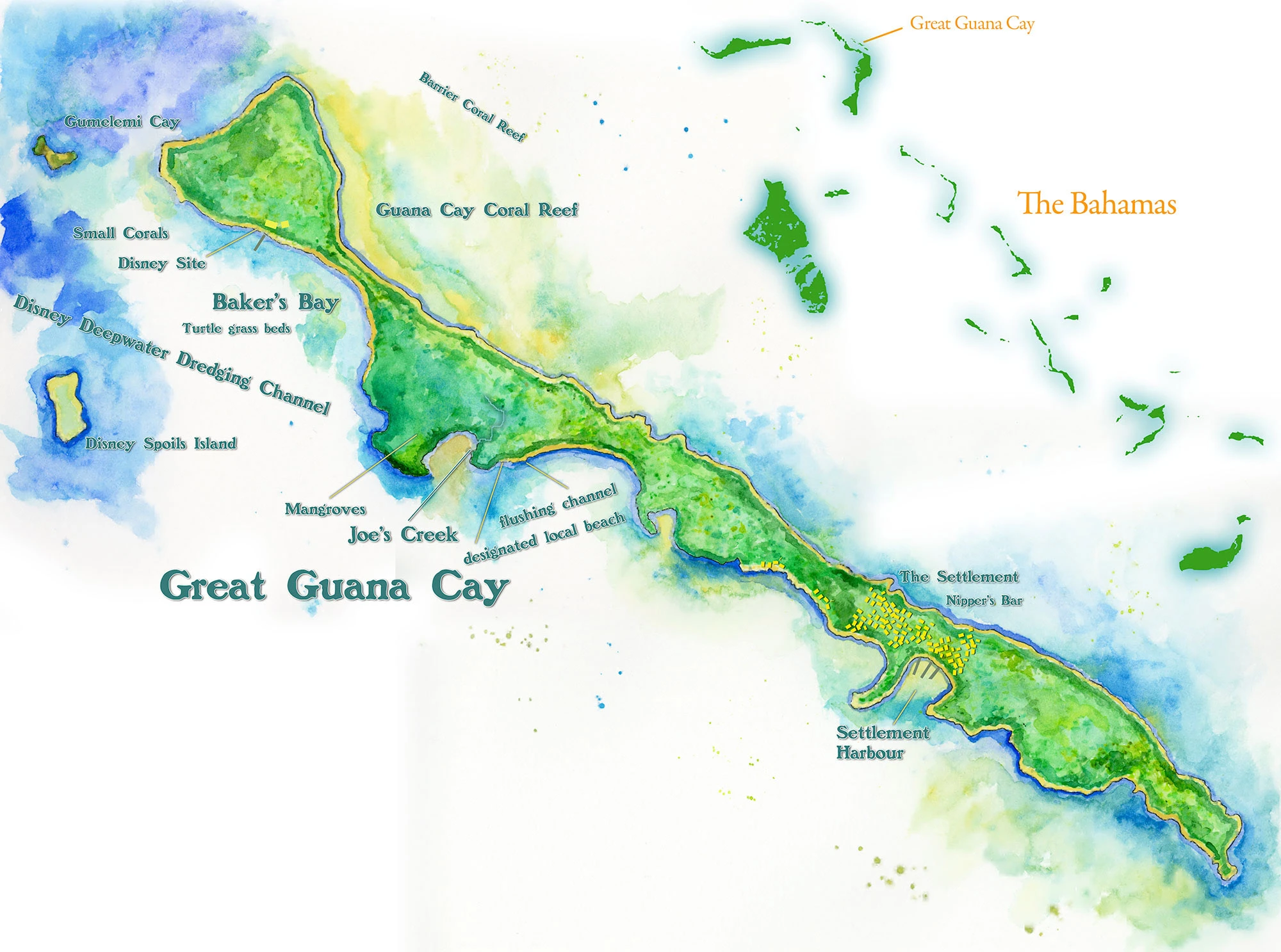
This map shows Great Guana Cay immediately prior to the construction of the Bakers Bay golf course development. The yellow symbols indicate buildings.
Developed Great Guana Cay Map
This overlay version of the map indicates the real estate that would be developed for the golf course (in green), and real estate that would be developed as private homes (in red).

Guana Cay Map with Bakers Bay Property Type Overlay
This map overlays the private property bought by Discovery Land Company, plus the Crown Land, which was not designed to be used for profit by foreign companies, but for the betterment of Bahamians.

Explore more in Maps
Adriatic Sea Map
Watercolor, Copic markers and liner pens.
Cyclades Map
Watercolor, Copic markers and liner pens.
Celestun Map
Copic markers and liner pens
Cuba Map
Watercolor and liner pens..
Nicaragua Map
Watercolor, photography and liner pens.
Panama Map
Watercolor and liner pens.
Honduras Map
Watercolor and liner pens.
Europe Map
Watercolor, Copic markers and liner pens.
Hispaniola Map
Watercolor, ink and liner pens.
West Indies Map
Watercolor, Copic markers and liner pens.
Salton Sea Map
Watercolor and liner pens.
Oregon Map
Watercolor and liner pens.
Portugal Map
Watercolor and liner pens.
Ecuador Map
Watercolor and liner pens.
Hawaiian Islands Map
Copic markers, watercolor and liner pens.
Morocco Map
Watercolor and liner pens.
Sicily Map
Watercolor and Copic Markers.
Abaco Map
Watercolor and Copic Markers.
Baja Peninsula Map
Watercolor and liner pens.
Guana Cay Map
Watercolor and inks.
Seward Peninsula Map
Watercolor and liner pens.
Osa Peninsula Map
Watercolor and Copic marker.
Baja Peninsula Map
Liner ink and watercolor.
St. Lucia Map
Sketched with Copic markers and watercolor.