
Nicaragua Map
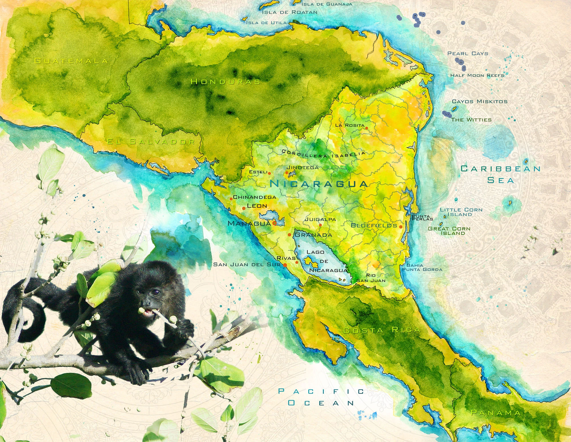
I painted this map of Nicaragua with watercolors and other mixed media. A version of this map was used by a Travel Channel pilot episode.
Updated September 29, 2026
Stories from Nicaragua: Granada · Mombacho Volcano · The Pacific coast · Nicaragua sketches
Nicaragua is the largest country in Central America, and the map shows why it has always been two countries in one. The Pacific side is a narrow lowland strip crowded with volcanoes, colonial towns and most of the people: Chinandega and León in the northwest, Managua on the shore of its lake, then Granada, Rivas and the surf town of San Juan del Sur. The Caribbean side is the Mosquito Coast, a vast, wet, thinly settled country of rivers, lagoons and rainforest, for most of its history reached by sea rather than by road. Bluefields, the lagoon at Punta Perlas and the mining town of La Rosita belong to a different world from the west, one of Creole, Miskito and Garifuna communities with a history of their own.
Between the two coasts lie the great lakes. Lake Managua spills south into Lake Nicaragua, the largest lake in Central America, and from its southern end the Río San Juan runs east along the Costa Rican border to the Caribbean. That low water route across the isthmus carried gold rush travelers from New York to California, and for generations it was considered the likeliest path for a canal between the oceans. In the lake, painted here as a figure eight, is Ometepe, an island made of two volcanoes, Concepción and Maderas, and in its waters swim bull sharks that come up the San Juan from the sea. North of Managua, the coffee and pine highlands around Estelí and Jinotega rise into the Cordillera Isabelia. Far out to the east are the Corn Islands, the Pearl Cays and the reefs of the Cayos Miskitos.
In the lower corner of the map, a howler monkey feeds in a tree. Howlers are among the loudest animals in the Americas, and at dawn on the Pacific coast their calls carry for miles.
My Travels in Nicaragua
Jane and I traveled up Nicaragua’s Pacific side, beginning in the dry forest north of San Juan del Sur, where troops of howler monkeys woke us in the mornings, a trip I wrote about in The Howling Coast. From there we went on to the old colonial city on the shore of Lake Nicaragua in Granada Libre, and talked our way past a guard station into the cloud forest of Volcán Mombacho, the story I told in Jungle in the Sky. The sketches from the trip are in my Nicaragua Moleskine Travel Journal.