
Portugal Map
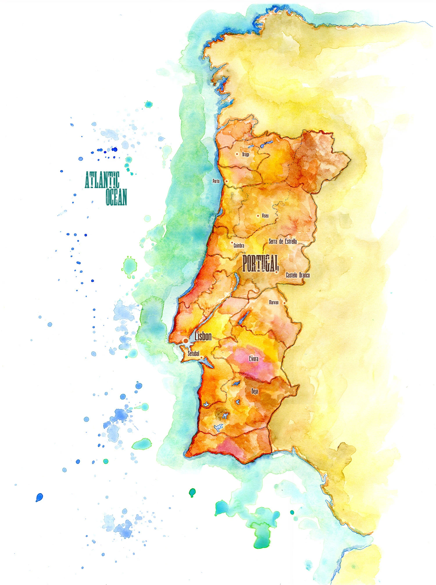
For this map of Portugal, I used watercolors that represent the colors that I associate with Portugal and its regions. I have synesthesia, which means that I associate colors with other senses, and I can never separate a place from its intrinsic color palette.
Updated September 29, 2026
Stories from Portugal: Alfama, Lisbon
Mainland Portugal is a narrow rectangle on the Atlantic edge of the Iberian Peninsula, about 350 miles from north to south and never much more than 130 miles across. The ocean runs down its whole western side and wraps around the south, and its border with Spain is one of the oldest in Europe, fixed for most of seven centuries. Nearly every important city sits near the water or on a river mouth: Porto on the Douro, Lisbon on the broad estuary of the Tagus, Setúbal on the Sado.
The north, around Braga and Porto, is wet, green and crowded with small farms and vineyards. Inland, past Viseu and the old university town of Coimbra, the land rises into the Serra da Estrela, the highest mountains in mainland Portugal, where shepherds still make the country’s most famous cheese. East of the Tagus, Castelo Branco and the castle town of Marvão watch the Spanish frontier. South of Lisbon, the Alentejo opens into hot, rolling plains of wheat and cork oak around Évora and Beja, and below it the Algarve runs along the south coast.
The cork oak country of the Alentejo is some of the best wildlife habitat left in western Europe. Great bustards display on the open plains, azure-winged magpies move through the oaks in noisy bands, and the Iberian lynx, which came close to extinction in the early 2000s, has been reintroduced to the Guadiana valley in the far southeast. Lisbon itself was nearly erased by the earthquake of 1755, and the old Moorish quarter of the Alfama is almost all that survived it.
My Travels in Portugal
Jane and I walked the Alfama in the rain, which I wrote about in Faded Majesty: The Alfama, Lisbon. We crossed the country again on our cheese travels, from the Spanish border to Covilhã in the Serra da Estrela, then down to Évora, Setúbal and Azeitão, in Mission in the Sun: From Andalucía to the Alentejo. That whole route, from Tangier to the Alps, is on my Europe map.