
The Baker's Bay Monitoring Reports
Twelve representative reports from Baker's Bay's environmental monitoring records track two years of turbidity, buffer zones and trash — filed to an executive of the company being monitored, and almost never looking at the coral reef, turtle grass and mangroves they existed to protect.
Updated October 2, 2026
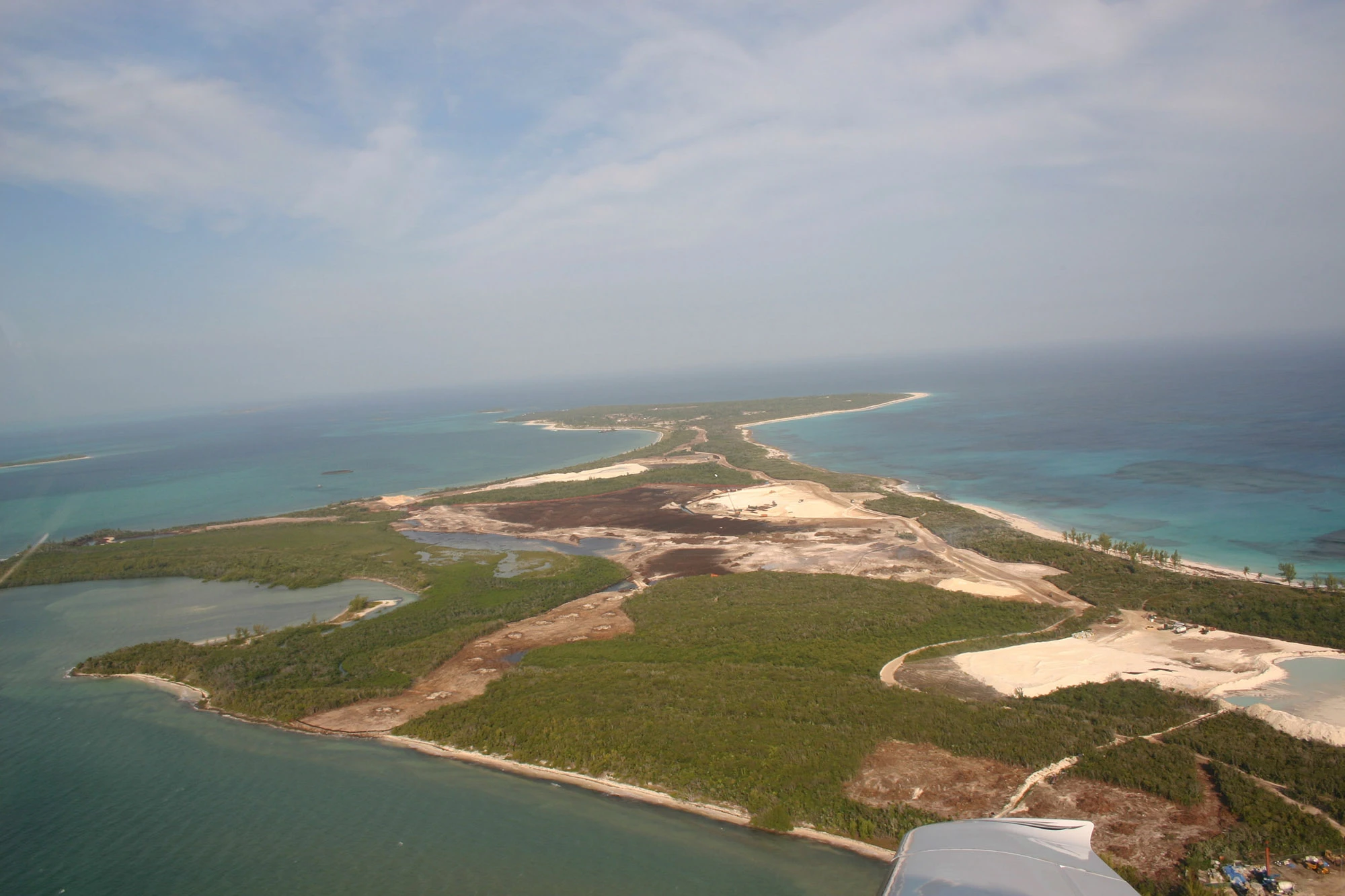
What follows is built from twelve representative reports out of Baker's Bay's environmental monitoring records, written by Dr. Kathleen Sullivan-Sealey, a University of Miami marine scientist. From 2005 through at least 2008, her team served as the Environmental Management Team (EMT) contracted to monitor construction at Baker's Bay Golf & Ocean Club against the goals of its Environmental Impact Assessment: water quality, coastal buffer zones, groundwater, wetlands, and solid waste. The set covers a March 2005 pre-construction baseline and eleven site-visit reports running from February 2007 through December 2008.
These documents look like diligence. Someone was on the ground nearly every month with instruments, checklists and photo logs, and the reports are dense with readings, scores and recommendations. But look at what all that effort was pointed at. Almost none of it measured the coral reef, the turtle grass beds or the mangroves — the three living systems that made Great Guana Cay worth protecting, and the ones the development most threatened. And the findings went, as the record below shows, to an executive of the company being monitored. The paperwork is real. The protection it implied was not.
What These Documents Are
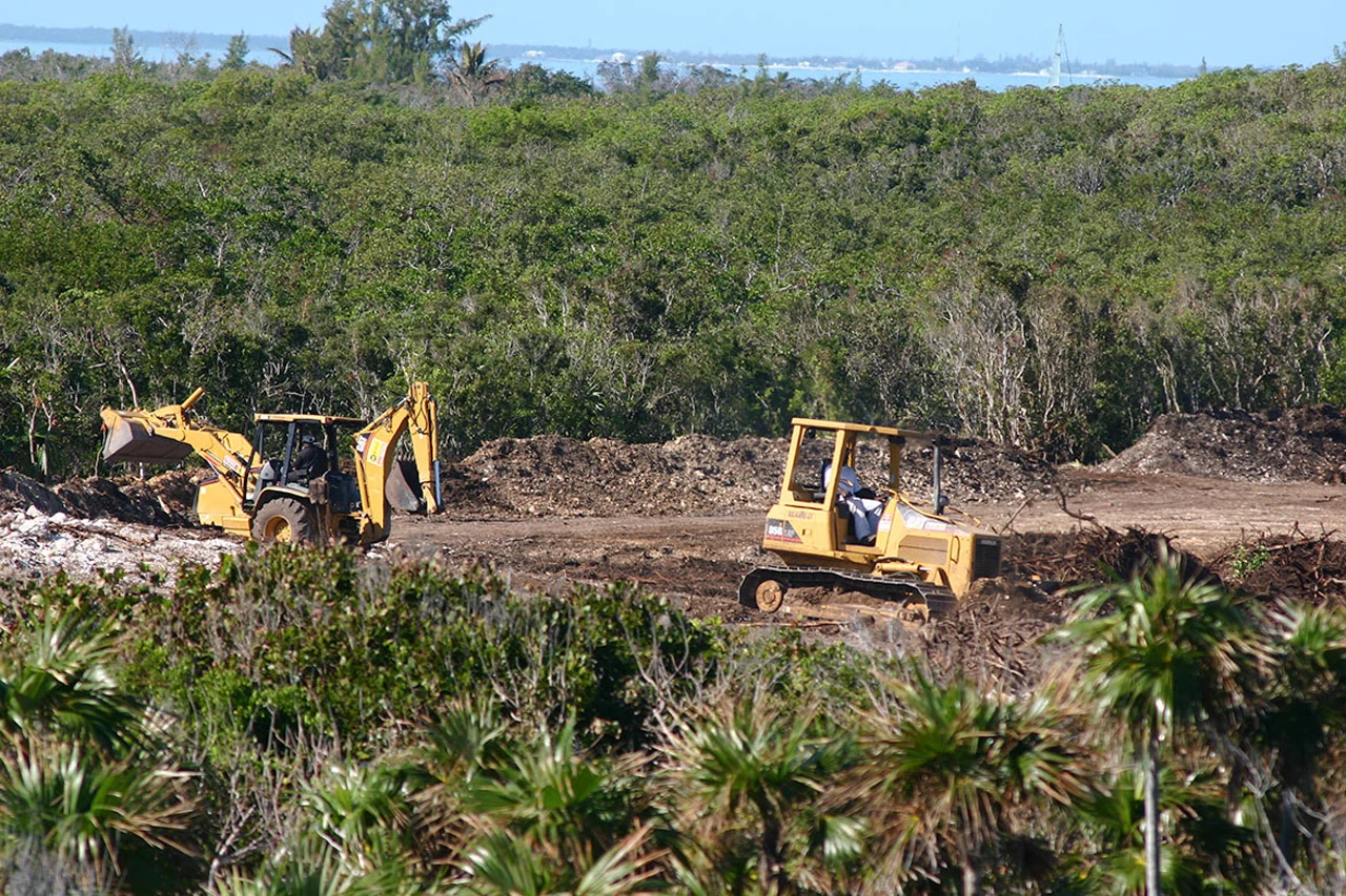
Baker's Bay's 2004 Environmental Impact Assessment came with an Environmental Management Plan attached, and the Plan came with a monitor: the University of Miami, under a paid, multi-year services contract with the development. Dr. Sullivan-Sealey and a small rotating team (a research associate, sometimes a graduate student or a College of The Bahamas intern) flew to Great Guana Cay roughly monthly. Over three to six days they surveyed water quality and turbidity at the marina and dredged channels, walked the coastal buffer zone lot by lot, checked groundwater wells, counted plant species in the preserve areas, and reviewed construction progress against the site's own environmental checklist. Each trip produced a memo: a narrative cover letter summarizing the visit's findings, followed by a standardized "Monitoring Criteria for Construction" checklist scored yes/no across ten to twelve categories, with photo logs and appendices attached.
The earliest document in this set is different in kind. Dated March 2005, before any of the reports below, it's a formal monthly report addressed directly to the Bahamas Environment, Science and Technology (BEST) Commission, the government body that approved the original EIA. It reads like a compliance filing: goals, a plant inventory, upbeat progress notes, one minor incident (someone cut branches from a protected buttonwood tree) reported and resolved. Every other document in this set is a different kind of paper trail entirely: an internal trip report, addressed not to a government regulator but to a single named recipient inside the project, Dr. Livingston Marshall, a distinction that turns out to matter a great deal (see below).
Before Construction: The March 2005 Baseline
The March 2005 report is worth reading precisely because of how ordinary it sounds. The EMT lists Baker's Bay's four stated environmental goals verbatim from the EIA (preserve the island's native vegetation communities, hold water quality at pre-construction levels, enhance wildlife habitat in the preserve areas, keep the coastline stable) and reports steady, unremarkable progress toward all four: a plant inventory underway, monitoring plots being set up on a 200-meter grid, an outreach database started, a golf-cart trail cut with only about ten meters of natural vegetation lost. Even the "Incidents, Complications, Challenges" section is mild: a few cut branches, an invasive scale insect not currently a problem thanks to a lucky assist from two 2004 hurricanes. This is the model working as designed: a baseline against which everything that follows can be measured.
The Record, Visit by Visit
Read in sequence, the eleven site-visit reports from February 2007 through December 2008 tell a very different story than the 2005 baseline. The same handful of problems recur, are logged, are promised a fix, and reappear in the next trip report months later. Below is what each visit found, quoting the EMT's own language where it's most direct.
| Site Visit | Report Filed | What It Found |
|---|---|---|
| Mar 2005 | Mar 2005, to BEST Commission | Pre-construction baseline: plant inventory underway, monitoring framework established, one minor buffer-zone incident resolved informally. |
| Feb 1–2, 2007 | Mar 7, 2007 | “Expediency is supplanting innovation”: clearing has outpaced environmental safeguards, and four of the ten original monitoring plots have already been destroyed by changed construction plans. |
| Mar 11–15, 2007 | Apr 20, 2007 | Only three of the planned groundwater wells are usable; the well nearest the future tennis center is anoxic with high sulfur content from decomposing peat under the fill. |
| Apr 24–27, 2007 | May 8, 2007 | Sediment curtains at the marina found “torn or left in disrepair”; dredging described as “haphazard,” damaging seagrass beds and exposing rhizomes. |
| Jun 12–16, 2007 | Jul 26, 2007 | Acute turbidity events recorded by the EMT's own instruments “do not show up on the routine monitoring” done by the dredging contractor, American Bridge. |
| Jul 23–27, 2007 | Aug 16, 2007 | Coastal buffer zone survey of five lots: dune and swale restoration incomplete at every one surveyed. |
| Dec 12–18, 2007 | filed Aug 28, 2008 | “Solid waste practices may be the single most important environmental issue” on site; trash dumped in the dumpsters, in the bush, and in the sea. |
| Jan 29–Feb 2, 2008 | Feb 25, 2008 | A pumping error has flooded a mangrove wetland with saltwater, damaging its hydrology; the EMT recommends leaving it to recover naturally. |
| Mar 7–13, 2008 | Apr 16, 2008 | New coastal buffer zone scoring system introduced; surveyed lots score 41–71% (“Fair” to “Good”); none score “Excellent.” |
| Apr 24–29, 2008 | Jun 16, 2008 | Turbidity readings “in excess of 100” NTU recorded outside the marina entrance during dredging and barge operations. |
| Jun 27–Jul 2, 2008 | Aug 5, 2008 | Overfishing observed on the Atlantic-side reefs; an active fish trap with a nurse shark inside found off the developer's own dock. |
| Dec 9–14, 2008 | Dec 18, 2008 (final report of the contract's third addendum) | The marina's sediment curtain was “never in place” for the entire visit; turbidity inside the marina averaged roughly 30 times higher than outside it. |
Four Problems That Never Got Fixed
Turbidity and Sediment
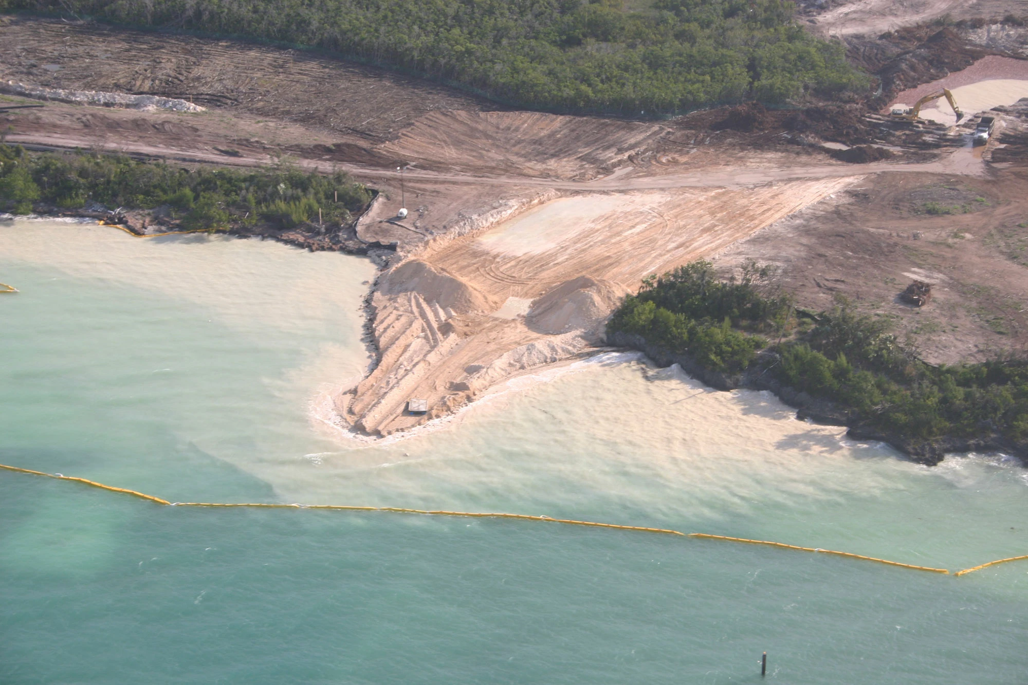
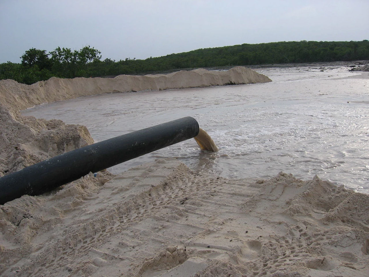
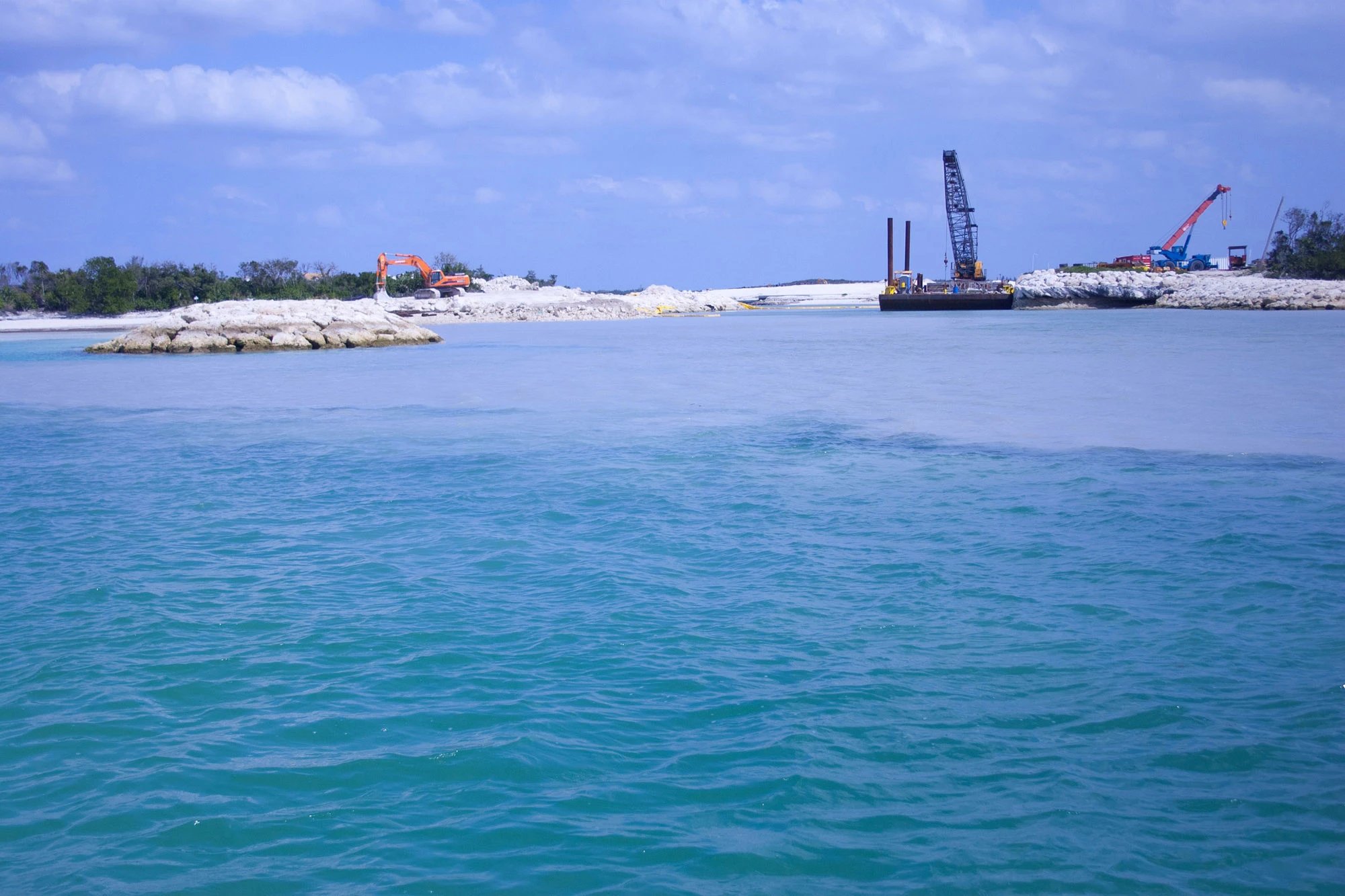
This is the most consistently documented failure in the whole set. Sediment curtains (the floating fabric barriers meant to contain dredge plumes) are reported torn, too short, or simply removed in visit after visit across nearly two years, from May 2007 ("torn or left in disrepair") through the final December 2008 report, which states plainly that the curtain "was never in place during the duration of our visit," and calls it "unacceptable to have the curtain permanently removed" even temporarily for boat traffic. The EMT's own instruments, deployed independently of the contractor's monitoring, repeatedly caught turbidity spikes that the dredging contractor's routine reporting missed. By the final report, the gap between water quality inside and outside the marina, the exact comparison the EIA itself set as the standard to meet, was still wide open, nearly two years after it was first flagged.
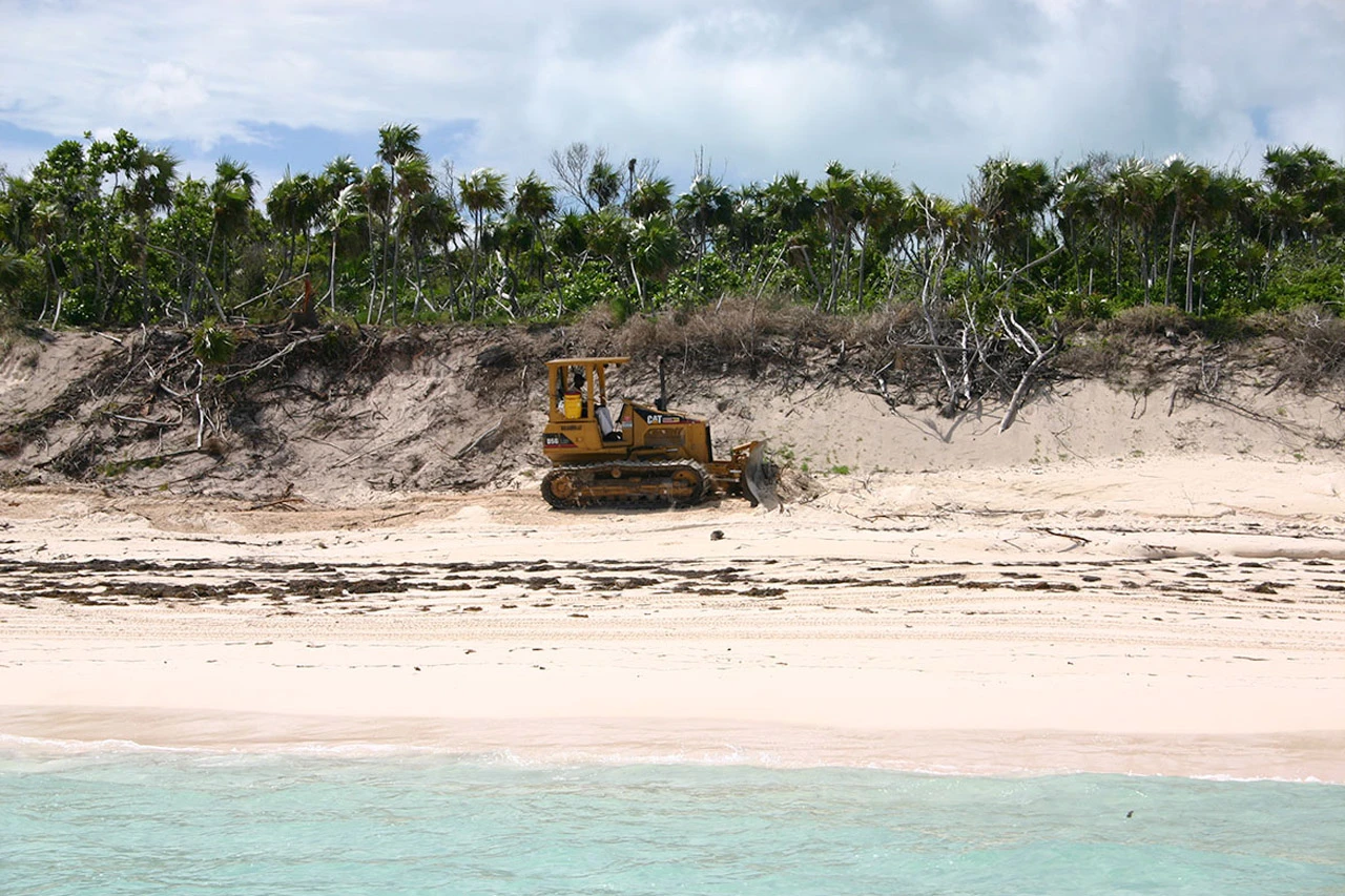
The Coastal Buffer Zone
The dune-and-shrub buffer between construction and the shoreline is the single feature the EMT returns to most often, because it does three jobs at once: it holds the coast together in storms, filters runoff before it reaches the sea, and is the last refuge for native plant diversity on lots that have otherwise been cleared. Report after report finds it incomplete: not planted, not measured correctly, or "thinned" and "under-cut" in ways the 2004 EIA specifically warned against. By March 2008, more than a year after the first buffer-zone complaint, the EMT's own scoring system rated surveyed lots no higher than "Good," with several still "Fair."
A December 2008 outreach sheet titled "Five Things You Can Never Do In a Coastal Buffer Zone" (never remove trees, never thin it, never walk across it, never alter it without consulting the EMT) reads less like general guidance and more like a list of things the EMT had just watched happen, again.
Groundwater
Guana Cay sits on porous limestone with no real soil layer to filter anything, which is the same geology that makes the island's coral reefs vulnerable to fertilizer and runoff (see my reporting on golf courses and coral reefs). The EMT's groundwater wells told a quieter but equally telling story: of the original planned wells, only three were ever usable, and the one nearest the leisure center repeatedly tested anoxic, with high sulfur and nitrogen from decomposing organic peat trapped under fill dirt. This is exactly the mechanism the EIA's own goals were meant to prevent: land filled and graded over wetland peat, with nowhere for the resulting nutrient load to go but down into the water table and out to sea.
Solid Waste
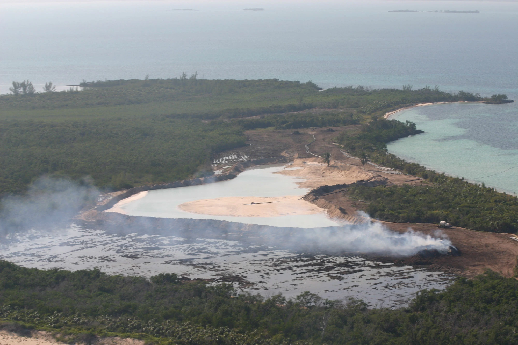
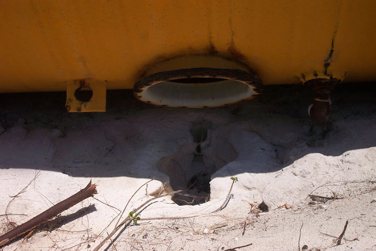
By December 2007, nearly a year into this batch of reports, the EMT called solid waste "perhaps the most important area for all of us to consider and address," describing "everything imaginable dumped both in the dumpsters, in the bush and in the sea." Photos from later visits show open, lidless dumpsters and a fisherman cleaning his catch directly into the water off the logistics dock. A formal sorting and composting plan is discussed, deferred, and discussed again across at least three more reports through 2008.
What the Reports Didn't Watch
Read the findings above again and notice what's missing. The reports measure turbidity, sediment curtains, buffer-zone lots, groundwater wells and trash. These are stand-ins: things that are easy to check from a boat or a beach path, and that matter only because of what they might do to the living reef, seagrass and mangroves downstream. The living systems themselves barely appear. Across the findings logged in these twelve reports, the Atlantic reef surfaces once, in a June 2008 note about overfishing and a fish trap off the developer's own dock. Seagrass appears as collateral damage from haphazard dredging. Mangroves appear when a pumping error floods one with saltwater. None of it amounts to a measurement of how the coral was doing over time.
That wasn't the plan on paper. The Environmental Management Plan promised twice-yearly surveys of coral growth, coral disease, fish and seafloor communities, and a quarterly “Marine Status Report” scoring hard-coral growth, coral health, marine plants, fish and sedimentation (the plan's Figure 14). No such report, and no coral survey result, appears among the findings in this set.
The project's own assessment had already conceded why the stand-ins weren't enough. The 2004 Environmental Impact Assessment, citing Sullivan-Sealey's own earlier water studies, notes that around New Providence, “despite alteration to 100% of the shoreline along Eastern Road, with loss of reef and seagrass habitats,” water-quality patterns were “not statistically different” from those around lightly developed islands — and concludes that detailed water quality monitoring is “essential for remediation of problems associated with coastal development, but not necessary for the identification or prediction of ecological impacts” (Part 1, p. 60). In other words, the developer's own scientists had written that the water can test normal while reefs and seagrass are being lost. Then they ran a monitoring program built around testing the water.
The right expertise was never part of the paid program, either. The monitoring team was Sullivan-Sealey, a research associate, and a rotating graduate student or intern. Sullivan-Sealey's published research at the time centered on nearshore fish, seaweeds and coastal water quality; no one on the team was a coral reef specialist.
The coral science in this story came from outside, paid for by the islanders or donated. Dr. Michael Risk, a marine biogeologist with forty years on Caribbean reefs, hired by the Committee to Save Guana Cay Reef, warned in February 2004 that “protection of the marine environment from land-based stresses produced by the project is not well documented, nor have adequate baseline data been taken.” Dr. James Cervino and Dr. Thomas Goreau ran reef transects near Baker's Bay pro bono in 2004, 2005, 2006 and 2008, and in 2012 documented coral disease and fertilizer-fed algae beside the golf course. That is the reef record of Great Guana Cay. The developer's monitoring program didn't produce it.
Where These Reports Actually Went
Every one of the eleven site-visit reports in this set (the ones that document the torn curtains, the incomplete buffer zones, the anoxic wells, the dumped trash) is addressed the same way: "To: Dr. Livingston Marshall." Only the earliest document, the March 2005 baseline, goes to the BEST Commission, the government body that actually approved the project's EIA. I don't know, from these documents alone, whether or how the findings below that first report ever reached BEST Commission or any other government body.
Dr. Livingston Marshall is a credentialed marine scientist in his own right: a graduate of Hampton University with a Ph.D. in Marine Science from the Virginia Institute of Marine Science, and by his own account the first Bahamian to hold one. But according to his own published biography, he has held a leadership post at Baker's Bay Golf & Ocean Club since 2005, the same year this monitoring relationship began, eventually as Senior Vice President of Environmental & Community Affairs, and since 2012 as a partner in Passerine at Abaco Holdings, Ltd., the development's own parent company.
In other words: for the two years covered by this batch of reports, the University of Miami's monitoring findings were not going out to an independent regulator or an academic oversight board. They were going, internally, to a Baker's Bay executive who would later hold an ownership stake in the company those findings concerned.
The point isn't that the people making these visits didn't care; some of the language in the memos is blunt. The point is that a monitoring program can be busy, detailed and sincere and still be built so that it never measures the thing at stake and never has the power to stop anything. This one had, structurally, no independent teeth: no regulator with stop-work authority in the loop, no public disclosure requirement, no consequence attached to a finding beyond the recommendation itself, filed again the following month.
What This Adds Up To
What these reports add up to is the appearance of diligence. Monthly visits, instruments, checklists scored yes or no, buffer lots graded in percentages: it reads like close scientific oversight, and the developer presented it that way, as a University of Miami team watching over the island. But the oversight was aimed at the edges of the problem. It counted trash and measured sediment curtains while the coral reef, the turtle grass and the mangroves — the things this whole fight was about — went largely unmeasured, and what it did find went to a company executive rather than to a regulator or the public.
That is the model worth understanding, because it is used at coastal resorts and marinas around the world: a developer-funded team, advisory only, reporting to the developer, checking proxies instead of the ecosystem. It produces paper that looks like protection. On Great Guana Cay, the actual record of what happened to the reef had to come from outside scientists working for free, and by 2012 that record showed coral disease and fertilizer-fed algae next to the golf course.