
The Mangroves Bakers Bay Destroyed
A barrier-island world with almost no equivalent left in the western Atlantic — the reef’s filter and its nursery — dredged out for a marina that leaks the poisons it once strained.
September 21, 2026
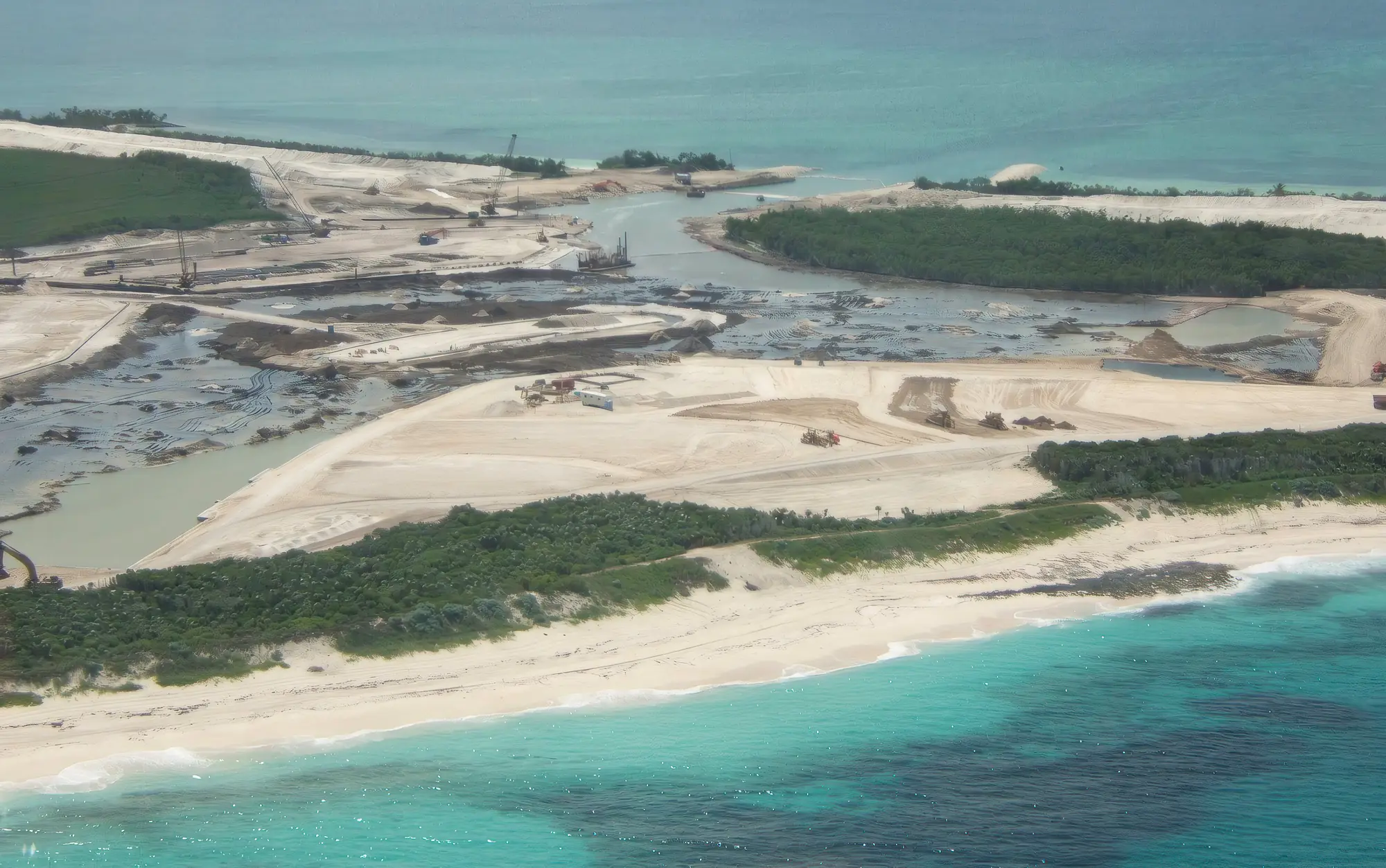
To build its marina, Bakers Bay dredged out the mangroves. The golf course is the half of this story people know — the fertilizer, the nutrients bleeding onto the reef. The destruction of the mangroves is the half they don’t, and it was every bit as lethal: not a lesser harm beneath the golf course but its equal, and the one almost no one talks about.
To understand it, you have to understand where it happened. The north end of Guana Cay is not generic swamp. It is a barrier-island world with almost no equivalent left in the western Atlantic — an open-Atlantic coral reef on the ocean shore, a belt of dense coppice forest along the barrier itself, and, on the sheltered Sea of Abaco side, an estuarine nursery, all stacked across a few hundred meters at the exact point where a continent’s migrating birds first touch land. The mangroves were the linchpin holding it together. A golf green can be re-sodded. This could not be rebuilt.
This is the least visible part of the Bakers Bay story — and, ecologically, no less decisive than the golf course that overshadows it.
The First Land a Continent’s Birds Touch
Great Guana Cay is a thin barrier at the northeastern edge of the Little Bahama Bank, at the northern limit of the tropical western Atlantic — and that position is everything. The cay is a seam between two worlds of water: the deep, open Atlantic on its eastern shore and the shallow Sea of Abaco, on the bank, to its west. Each autumn, migrating songbirds leave the North American coast, staging in enormous numbers at bottlenecks like Cape May before launching out over open water toward the tropics. The northern Bahamas — Abaco and Grand Bahama alone — are the first land they reach on the far side of that crossing.
This is not one stopover among many. In migration ecology, the first landfall after a long overwater flight is the one that matters most: the birds arrive spent, and whether they find dense cover and food in the first forest they hit is, for many of them, the difference between completing the journey and not. Abaco and Grand Bahama are that first forest for the whole eastern edge of the flyway. More than half of the roughly 300 bird species recorded in the Bahamas are migrants from the U.S. and Canada, and over thirty species of shorebird alone cross to these islands each fall.
And among the barrier cays — the outer islands that are the true first landfall, the strip of land that actually separates the open Atlantic from the shallow bank — the north end of Guana Cay held the thickest coppice of all. That is not a distinction about acreage; Great Abaco behind it is far larger. It is about position: the densest, richest cover on the very edge that migrants reach first, some of the best first-landfall habitat on the entire leading line of the crossing.
That is not an abstraction to me. I have personally recorded on the order of twenty warbler species on Guana Cay in migration — American Redstart, Cape May, Black-and-white, Northern Parula, Prairie, Ovenbird, and more, coming down out of an autumn sky into that forest. Twenty warbler species on one small cay is not luck; it is what a first-landfall forest looks like while it is still intact. Bakers Bay cleared and burned the thickest of it.
The habitat’s value doesn’t end with the passage migrants. Two globally significant birds depend on precisely these barrier-island habitats through the winter. The Kirtland’s Warbler (Setophaga kirtlandii) — a species that came within a whisker of extinction and still numbers only a few thousand — winters largely within the Bahamas, in exactly the dense low coppice that covers cays like Guana, and has been recorded wintering on Abaco. The Piping Plover (Charadrius melodus), federally threatened in the U.S. and Canada, spends most of its year on Bahamian tidal flats and beaches; the 700 islands of the Bahamas provide a wintering ground for roughly a quarter of the world’s population — on the same flats that also raise bonefish, conch and juvenile sharks.
And the reef offshore is no more replaceable than the forest. Its builders are elkhorn coral (Acropora palmata) and staghorn coral (Acropora cervicornis) — the two great branching corals that have collapsed almost everywhere else in the Caribbean and are both now listed as threatened. A healthy Elkhorn–Staghorn stand, like the one Guana’s Atlantic shore is internationally recognized for, is one of the best remaining examples of a habitat that has largely disappeared from the wider Caribbean region. Reef on the ocean shore, first-landfall forest on the barrier itself, nursery flats on the bank side — and so little of any of it left anywhere. There is no equivalent to trade it for.
What a Mangrove Does for a Reef — and for Everything Else
A mangrove forest looks like wasteland to a developer — swampy, buggy, impossible to build on until you fill it. That perception is exactly why mangroves have been the easiest coastal habitat in the Bahamas to dredge, fill, or bridge. It is also completely wrong. On a low, porous limestone island like Guana Cay, the mangroves do three jobs the rest of the system cannot survive without.
They filter. Coral reefs are built for water so clean it would count as starvation anywhere else. Mangroves and the seagrass beds behind them trap sediment and strip nitrogen and phosphorus out of the water flowing off the land before it ever reaches the coral. On Guana that is not a metaphor: the island is porous limestone, so groundwater carrying golf-course nutrients travels straight through the rock to the sea. The mangroves were the last filter standing between the fertilized land and the Elkhorn–Staghorn reef.
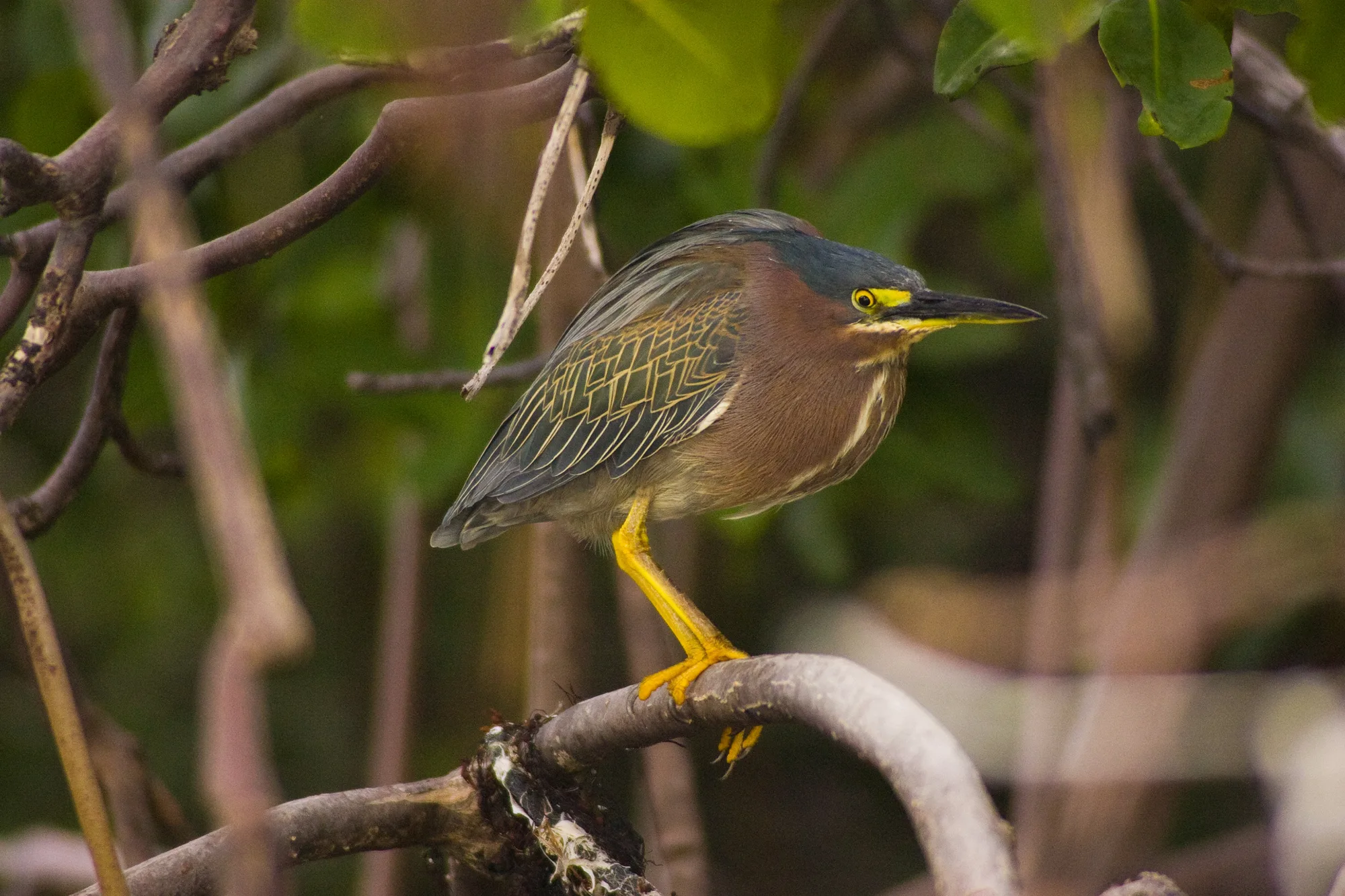
They shelter the young. The mangrove roots and the turtle-grass flats they shade are the nursery for the entire system. Juvenile lemon sharks (Negaprion brevirostris) patrol the root channels; spiny lobster (Panulirus argus), the Bahamas’ single most valuable fishery, settle out of the plankton into these vegetated shallows before ever reaching the reef; queen conch (Aliger gigas) graze the seagrass.
Whole generations of reef fish pass their infancy here before they see coral — gray and schoolmaster snapper (Lutjanus griseus, L. apodus), yellowtail snapper (Ocyurus chrysurus), bluestriped and French grunts (Haemulon sciurus, H. flavolineatum), and the Nassau grouper (Epinephelus striatus), now endangered, whose young hide in exactly these creeks. Even the rainbow parrotfish (Scarus guacamaia), the largest herbivorous fish in the Atlantic, depends on this nursery — Caribbean research has shown it effectively disappears where mangroves are cleared. And the bonefish (Albula vulpes) that underwrite the Abacos’ entire flats-fishing economy are raised on the same flats, alongside foraging green, loggerhead and hawksbill turtles, octopi, and the wading birds that work the shallows. The fishermen of Guana Cay depend on species that are, quite literally, born in the mangroves.
They hold the line in a storm. Mangroves absorb wave energy and storm surge — living shorelines, in the language of the restoration groups now scrambling to rebuild them. An island that trades its mangroves for a marina is an island with less protection the next time a hurricane comes.
A mangrove estuary, in other words, is not empty land awaiting a better use. It is the machinery that keeps the reef, the fishery, the flats, and the migration alive.
What Bakers Bay Actually Destroyed
Bakers Bay was fed by mangrove creeks — Joe’s Creek among them — that served as the estuaries for the island’s reef. Building the resort meant taking that machinery apart.
By 2009, as the scientists who monitored the site documented, the entire interior of northern Guana Cay had been cleared and burned — the same thick coppice that receives the fall migration — the mangroves dredged out to form a huge marina, a channel cut through the living seagrass of the Sea of Abaco to reach it, and the dredge spoil dumped on the low, swampy former mangrove flats as fill to build on. The silt curtains meant to contain the sediment failed; the plumes drifted past them and settled onto the seagrass and the reef beyond. Hundreds of ancient mangroves — the ones that buffered surge, filtered the reef, and seeded the fishery — were simply gone, and with them the shoreline flats that shorebirds like the plover work at low tide.
Joe’s Creek shows what “preserved” turned out to mean. Cut off from the tidal exchange that kept it alive, the back of the creek now sits stagnant, its forest visibly unhealthy. Because the island is porous limestone, some water still seeps beneath the sand, but the tidal breathing that made it an estuary is finished. Dr. Michael Risk warned in 2004 exactly how this would unfold — that a marina here would not flush adequately and the last mangrove habitat would suffocate — and it has happened as he described.
The Promise That Was Made, Then Quietly Withdrawn
As with the public park, the mangroves came with a promise. In paid advertisements in the local media, the developer assured residents: “Contrary to prevalent rumors, Joe’s Creek, the mangroves and the Guana Cay bonefish flats will all be preserved and not altered by development.”
They were not — and later the developer quietly reworded that assurance on its own website, the surest sign the original could no longer be defended. The developer’s own Environmental Impact Assessment had itself conceded that the habitat being cleared was a vanishing ecosystem. It was destroyed anyway.
The Marina Doesn’t Just Replace the Filter — It Poisons What’s Left
Dredging out the mangroves was only half the harm. A working marina is not a neutral hole in the water; it is a chronic, low-level chemical source — and at Bakers Bay it sits in a basin that, by design, does not flush. The marina opens onto the Sea of Abaco, the sheltered bank side of the island: not the Atlantic shore where the main reef lies, but the very water that holds the reef’s nursery — the mangrove creeks and turtle-grass beds where its fish, lobster, conch and bonefish are raised.
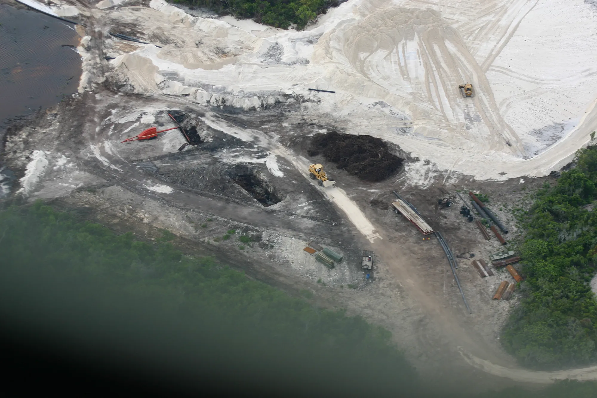
Dr. Risk warned in 2004 that a marina here would fail the U.S. EPA standard that a basin should flush a pollutant down to a safe threshold within four days. Whatever enters a poorly-flushed marina lingers and concentrates — and on porous limestone it does not stay put. It bleeds into the Sea of Abaco nursery on one side and leaches through the rock toward the Atlantic reef on the other. There is no shore of this island the marina’s outflow does not reach.
And a marina full of boats is fed a steady diet of contaminants — starting, remarkably, with the paint on the hulls.
Antifouling paint is engineered to poison. The coatings that keep barnacles and weed off a hull work by continuously leaching biocides into the water; killing marine life is the entire point of the product. For decades the biocide of choice was tributyltin (TBT), an organotin so destructive to marine invertebrates — deforming oysters, sterilizing whole populations of sea snails — that it was banned worldwide under international convention.
Its main replacement is copper, now the most common toxic ingredient in antifouling paint, and copper is directly harmful to coral: at very low concentrations it impairs coral fertilization and larval settlement and drives the loss of the symbiotic algae that keep coral alive. To handle copper-resistant fouling, paints add “booster” biocides, and one of the most widely used, Irgarol 1051 (cybutryne), is a photosynthesis inhibitor that bleaches reef-building corals at trace levels. It has been detected in coral-reef waters around the world, accumulates in marina sediments, and was banned outright in 2023 — precisely because of what it does to reefs. Even flakes of spent antifouling paint, shed during hull cleaning or from neglected boats, are so loaded with copper and zinc that they contaminate the sediment around moorings for years.
That is the part most people never think about: a few hundred antifouled hulls, floating in a warm, quiet basin cut into the coast, are a distributed source of exactly the metals and herbicides that corals cannot tolerate.
The paint is only the beginning. A marina also collects fuel and oil from engines — two-stroke outboards discharge a share of their fuel unburned straight into the water — along with the polycyclic aromatic hydrocarbons that are toxic to coral larvae. It gathers sewage and gray water from boats, loading the water with the very nutrients that feed the reef-smothering algae; there is a bitter irony here, since the developer tried to blame offshore algae on boat sewage and island “cesspits” while building the largest concentration of boat sewage on the cay. Add the zinc bleeding off sacrificial anodes, the metals from routine hull maintenance, the turbidity kicked up by prop wash and boat wakes, and the periodic re-clouding of maintenance dredging, and the marina becomes a persistent chemical and sediment source where a filtering estuary used to be.
At Bakers Bay this is not hypothetical geometry. The marina was built for hundreds of vessels — the Heads of Agreement provided for a basin of up to 240 slips and moorings for mega-yachts — which means a very large area of antifouled hull sitting in a basin Risk said would not flush, discharging into the Sea of Abaco nursery on one side and leaching, through the island’s porous rock, toward one of the last healthy Elkhorn–Staghorn reefs in the region on the other.
They marketed it as “Blue Flag.” For all of this, Bakers Bay sold its marina as an environmental showpiece. In its own materials it claimed the marina would be “among the first in the Bahamas to be certified as a ’Blue Flag’ operation” and “held to the highest cleanliness standard in the industry.”
But Blue Flag is not a slogan a developer awards itself. It is an international eco-certification run by the Foundation for Environmental Education, granted to a marina only after it satisfies dozens of criteria on water quality, waste handling, environmental management and education — and renewed by inspection every single year. It is real, it is rigorous, and it is attainable: Bimini Sands, on South Bimini, earned it in 2013, one of only a handful of Bahamian marinas ever to fly the flag. Bakers Bay was not one of them.
When I took the developer’s Blue Flag marketing to the organization that actually awards the certification, I was told Bakers Bay would never qualify — and the Blue Flag group went on to condemn the development for advertising a relationship with them that did not exist. To this day Bakers Bay does not appear among the world’s certified Blue Flag marinas. The cleanest-marina-in-the-industry claim was, like the park “on the Sea of Abaco” and the “preserved” mangroves, a marketing line the record simply does not support.
And here is the cruelty of the exchange. The mangroves and seagrass that were dredged away to make the marina are precisely the system that would have filtered copper, hydrocarbons, and nutrients out of the water before they reached the nursery or the reef. In a single act, the reef lost its kidney and gained a faucet. The estuary that protected it was removed, and the thing built in its place quietly leaks the poisons the estuary existed to catch.
Why It Was a Major Loss — for the Island and for the Abacos
Because mangroves are the foundation of the Abacos’ fisheries and flats-fishing tourism, because this is a first-landfall forest for the eastern flyway, and because the barrier-island configuration at Guana’s north end is genuinely rare, the loss reaches far beyond one cay’s shoreline.
That became brutally clear in September 2019. When Category 5 Hurricane Dorian stalled over the northern Bahamas, the mangrove die-off was severe enough to be seen from orbit. Bonefish & Tarpon Trust reported damage to 40 percent of mangrove habitat on Abaco and 73 percent on Grand Bahama; later, more precise mapping by the Perry Institute for Marine Science found that over 10,000 acres of Abaco’s mangroves, roughly 14 percent, were killed outright, with thousands more damaged. Either way, tens of thousands of acres of living shoreline vanished in a matter of days — and the same storm shredded the coppice and pine that the islands’ birds, resident and migrant alike, depend on.
That is the context that makes the Bakers Bay clearance matter beyond one island. Even before Dorian, the Perry Institute attributes the Bahamas’ pre-storm mangrove losses — on the order of 5 to 10 percent — to coastal development, dredging and land reclamation: the exact activities Bakers Bay carried out. Development had already been eating away at the northern Bahamas’ mangroves acre by acre; then a single storm took a huge share of what remained. Every acre a marina removes is an acre that cannot buffer the next surge, cannot reseed the flats, cannot regrow on its own the way an intact stand can — and cannot receive a migrant warbler in October or a Piping Plover in January.
And this was not marginal habitat. Bakers Bay cleared and burned the thickest coppice on the barrier cays — the outermost land, the true first landfall, the actual seam between the open Atlantic and the bank — at the precise point where the eastern flyway’s migrants come down. So the loss is subtracted not just from one island’s fishery but from the survival odds of a continent’s songbirds, at the one spot on the journey they can least afford to lose cover. The mangroves and coppice Bakers Bay dredged and burned were not just a loss in 2009. They were a loss the island could least afford by 2019, and a piece of the Abacos’ irreplaceable natural infrastructure that no restoration project can quickly put back.
The Root of It All
The reef decline at Bakers Bay is usually told as a story about golf-course fertilizer, and that story is true. But it is only half of one. The golf course and the marina were not a greater harm and a lesser one; they were two roads to the same end. The fertilizer alone, leaching through porous rock, was enough to poison the reef. The loss of the mangroves and seagrass alone — the reef’s filter and its nursery — was enough to unravel it. And the marina that took their place is no passive hole in the water; it is a chronic source of the very metals, hydrocarbons, and nutrients the estuary once strained out. Bakers Bay did not choose between these harms. It inflicted both, on one of the last intact barrier-island systems in the western Atlantic.
Dr. Risk saw it in 2004. The islanders saw it and said so, in court and in the press, for years. The mangroves and the coppice are the part of Great Guana Cay that will not come back in our lifetimes — a reef, a nursery, and a continent’s first landfall, all lost at once — and their destruction is why so much else was lost with them.