
Olympic Peninsula Map
I painted this map of Washington's Olympic Peninsula with watercolors and Copic markers.
Updated September 29, 2026
Stories from the Olympic Peninsula: Shi Shi Beach · Neah Bay
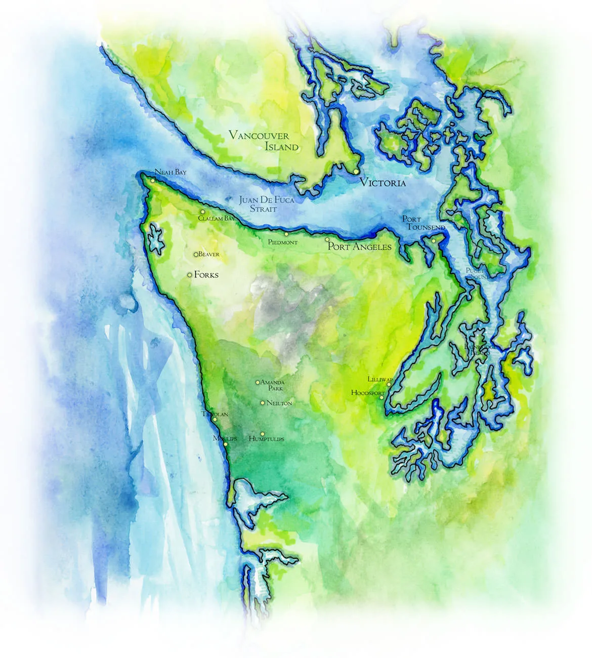
The Olympic Peninsula is the great knuckle of land at the northwest corner of the contiguous United States, bounded by water on three sides: the open Pacific to the west, the Strait of Juan de Fuca to the north, with Vancouver Island and the city of Victoria across it in Canada, and to the east Hood Canal and Puget Sound, a drowned country of glacial fjords, inlets and islands. The gray at the center of this map is the Olympic Mountains, a tight knot of peaks crowned by Mount Olympus at nearly 8,000 feet. No road crosses them. Every town on the map, from Neah Bay and Port Angeles to Forks, Amanda Park and Hoodsport, sits on the rim, strung along the one highway that loops around the peninsula.
The mountains make the weather. Storms off the Pacific break against the western slopes and drop twelve feet of rain or more a year in the valleys of the Hoh and the Quinault, feeding temperate rain forests of Sitka spruce, western hemlock and bigleaf maple hung with moss. In the rain shadow on the northeast side, around Port Townsend, the country is far drier. Olympic National Park now protects most of the interior and a long strip of wild coast, and it began as a refuge for the Roosevelt elk, the largest elk in North America.
During the ice ages, glaciers cut the Olympics off from the rest of the continent, and animals evolved here that live nowhere else: the Olympic marmot, the Olympic torrent salamander, the Olympic mudminnow, and two trout found only in Lake Crescent, near the little town of Piedmont on this map. Some mountain animals common elsewhere in the Northwest never arrived at all, and the mountain goats on the high ridges came with the help of people. The coast belongs in large part to its first nations, the Makah at Neah Bay and the Quinault at Taholah, and on the Elwha River, west of Port Angeles, two dams came down in the largest dam removal in American history, and the salmon have returned.
My Travels on the Olympic Peninsula
I drove up Hood Canal in a morning fog and crossed the northern edge of the peninsula for two permits, one from the park and one from the Makah Tribe, to backpack alone to the wild coast in Shi Shi Beach and the Dark Age of Travel. For The Artist & the Whale Hunter of Neah Bay, I talked with the Makah painter and carver Alex Swiftwater McCarty about the Ozette dig and the 1999 whale hunt.